Colorado Springs is a genuinely charming city, one of the most desirable cities in the US, with a delightful combination of elegant modernity and rich history. It is also an outdoor lover’s paradise, surrounded by stunning natural beauty thanks to the surrounding mountains and natural wonders such as Cave of the Winds, Garden of the Gods, and the remarkable rock formations of Red Rock Canyon and the Paint Mines.
Colorado Springs is also renowned as one of the best hiking destinations in Colorado and up there with the best places to hike in the US. It offers something for everyone, from gentle riverside walks to challenging mountain treks, all set against the stunning backdrop of the beautiful natural landscape. The best hikes in Colorado Springs include taking on the summit of Pikes Peak (the only Colorado Springs fourteener), as well as the more whimsical challenge of the Manitou Incline.
Pikes Peak is the most famous mountain in the Colorado Springs area, but with the Southern Rocky Mountains to the west, Cheyenne Mountain to the south, and Ormes Peak to the north, there are plenty of possibilities for avid hikers all over this delightful hiking city.
Table of Contents
The Top 10 Hikes In Colorado Springs
Easy hikes
Ute Valley Park Loop Trail
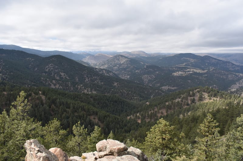
Image Source: Wikimedia Commons
- Location: 1645 Vindicator Drive, northwest Colorado Springs.
- Trail Length: 3.4 miles
- Trail Type: Loop
- Trail Difficulty: Easy to moderate
- Estimated Time: 1 hour 50 minutes
Ute Valley Park is one of the most popular parks amongst Colorado Springs locals. It stretches over 338 acres, a delightful wilderness of shaded forests, wide-open spaces, fascinating and eye-catching geological formations, and 20 trails of varying difficulties for hiking, trail running, and mountain biking.
The best and most famous trail in the park is the Ute Valley Park Loop Trail, which boasts glorious views of Colorado Springs itself and a beautiful panoramic vista of the Rocky Mountains. As a relatively manageable trail, it is family-friendly and perfect for an afternoon out with kids. Dogs are also welcome, although they must be kept on a leash.
Mesa/Greenlee Trail, Red Rock Canyon
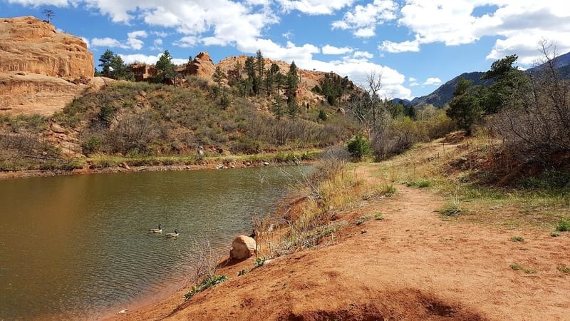
Image Source: Pixabay
- Location: Highway 24. 3550 W High St, Colorado Springs
- Trail Length: 2.85 miles
- Trail Type: Loop
- Trail Difficulty: Moderate
- Estimated Time: 55 minutes
Red Rock Canyon Open Space is one of Colorado Springs’ most attractive and interesting outdoor spots. Clocking in at an impressive 1,474 acres, the park is a local favorite, thanks to its beautiful, stark, almost Martian red rock landscapes, mountain scenery, and shady forests. It is also not often on tourist to-do lists, which gives it a delightful tranquil atmosphere and ensures plenty of space to park in one of the three lots, even on more crowded days.
The Mesa/Greenlee trail is one of the best of the 10+ trails that wind their way through the park. It takes you south to the bottom of the park (an uphill start) and then loops round to the trailhead, meaning that the second half of the hike is pretty much all downhill. You get excellent sightings of the rock formations in the canyons and a pretty spectacular view of Pikes Peak and Garden of the Gods.
Paint Mines Trail, Paint Mines Interpretive Park

Image Source: Dave Soldano, Flikr
- Location: 29950 Paint Mine Rd, Calhan
- Trail Length: 3.5 miles
- Trail Type: Loop
- Trail Difficulty: Easy
- Estimated Time: 1 hour 36 minutes
For something a little bit different, it is worth taking on the Paint Mines Trail and exploring the weird and wonderful scenery of the Paint Mines Interpretive Park. Thousands of years of wind and rain have created the remarkable Hoodoo formations that make this park such a special place, full of twisting, colorful ravines and bizarre, eye-catching geological points of interest.
The Interpretative Park is full of gorgeous flora and fauna, in particular a wide range of wildflowers and bird species. The signage is excellent and offers a perfect opportunity to learn about the history and ecology of the area.
It is worth familiarizing yourself with the trail in advance, as washouts often look like the trail itself. Dogs and bikes are not permitted in the park.
Rampart Reservoir and Rainbow Gulch – Woodland Park
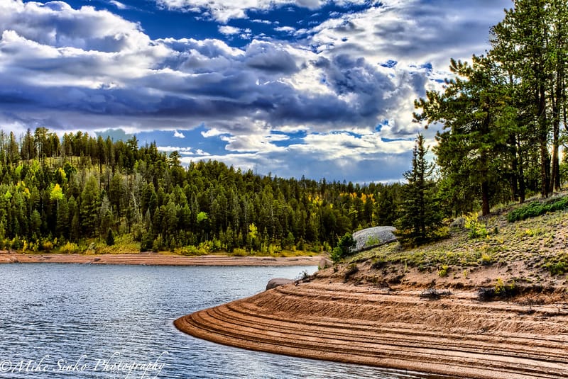
Image Source: Mike Sinko, Flikr
- Location: Rainbow Gulch Trail, Colorado Springs
- Trail Length: 3.1 miles
- Trail Type: Out and back
- Trail Difficulty: Easy
- Estimated Time: 1 hour 30 minutes
A delightful trail that follows the creek to Rampart Reservoir, Rainbow Gulch is a superb option for families. It offers some gorgeous scenery, with the aspens in the fall a particular highlight, and the wide dirt trail is also perfect for dog walking (leashed). The reservoir itself is delightful, a favorite haunt of anglers, while the house-sized boulders that line the route are pretty spectacular.
Challenging hikes in Colorado Springs
Palmer Trail
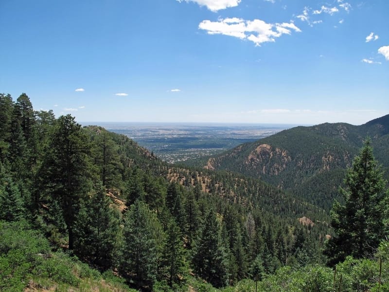
Image Source: Brokentaco, Flikr
- Location: Gold Camp Road, Colorado Springs
- Trail Length: 5.7 miles
- Trail Type: Loop
- Trail Difficulty: Moderate
- Estimated Time: 3 hours
Probably one of the most popular trails in Colorado Springs, the Palmer Trail can be deceptive. It starts gently and only really begins to get going in the second mile, as the route switchbacks through pine woods before hitting the peak at around two and a half miles. The summit is picturesque and offers a great rest stop, as the second part of the trail is almost all downhill. As a popular trail, it can get crowded on weekends and holidays, so go early or during the week, if you can.
The Manitou Incline Trail
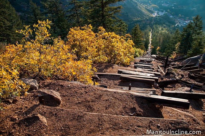
Image Source: Rob Lucas, Flikr
- Location: Manitou Springs, Colorado
- Trail Length: 4 miles
- Trail Type: Loop
- Trail Difficulty: Hard to expert
- Estimated Time: 3 hours
The Manitou Incline Trail is the remains of a Cog railway that once carried passengers to the top of Manitou Mountain. It is probably the most challenging hike in Colorado Springs, a crunchy, leg-destroying climb that boasts an elevation gain of 2,000 feet in just one mile and more stairs than the Empire State Building! This is genuinely a trail that should only be attempted by expert hikers in great shape. However, despite its grizzly reputation and description, it is one of the most exciting and rewarding trails in Colorado Springs, and if you are brave enough to risk wobbly legs the next day, the views from the top make it all worthwhile.
Hikes with Scenic views
Austin Bluffs and Pulpit Ridge, Austin Bluffs Open Space

Image Source: Wikimedia Commons
- Location: 6411 North Nevada Avenue, Colorado Springs
- Trail Length: 3.6 miles
- Trail Type: Loop
- Trail Difficulty: Moderate
- Estimated Time: 1 hour 50 minutes
Austin Bluffs and Pulpit Rock Park offer 584 acres of open space, with around 10 miles of trails set firmly inside Colorado Springs, making it one of the most convenient hikes in town. And with stunning views of both Garden of the Gods and Pikes Peak, it is also one of the most picturesque.
The loop trail that connects Austin Bluffs and Pulpit Ridge is excellent, with a lake, views of Pikes Peak from almost every angle, and a fantastic vista from the top of Pulpit Rock itself.
Talon and Sundance Trail, Cheyenne Mountain State Park
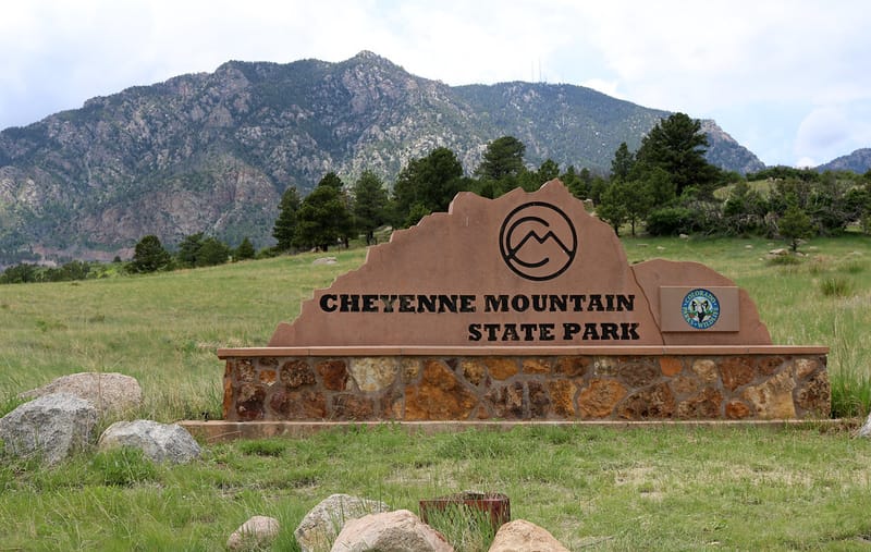
Image Source: Jeffrey Beall, Flikr
- Location: 410 JL Ranch Heights Rd, Colorado Springs
- Trail Length: 6.5 miles
- Trail Type: Loop
- Trail Difficulty: Challenging
- Estimated Time: 3 hours
One of the newest of Colorado’s state parks, Cheyenne Mountain State Park is an outdoor lover’s dream and a superb addition to Colorado Springs’ hiking network. Set in the shadow of the dramatic Cheyenne Mountain itself, the park boasts over 28 miles of trails of varying difficulties and brilliant camping facilities.
The pick of the hiking routes is the Talon and Sundance Trail, 6.5 miles of relatively challenging hiking with a fair amount of elevation with a great variety of scenery to keep you interested.
Barr Trail to Pikes Peak
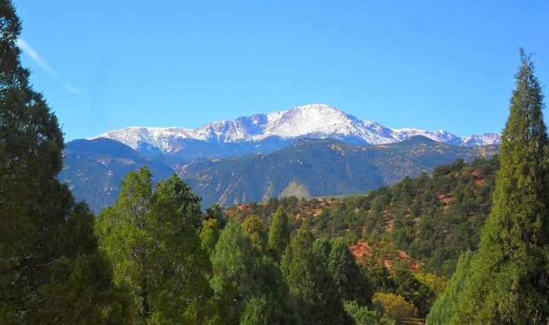
Image Source: Wikimedia Commons
- Location: 98 Hydro St, Manitou Springs, Colorado
- Trail Length: 24 miles
- Trail Type: Out and back
- Trail Difficulty: Expert
- Estimated Time: 15 hours
One of the most popular trails in the Pike National Forest, it is also one of the most challenging. A trail that stretches out for nearly 25 miles and includes over 7,400 feet of elevation gain, this is truly one for the hardier souls out there…but it is more than worth it for the stunning views from the summit. If you are keen to tackle this magnificent challenge, it is worth planning ahead, as Pikes Peak can get stormy, and you’ll need to set out early if you want to get up and down in a single day!
Bear Creek
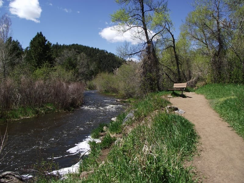
Image Source: Wikimedia Commons
- Location: High Dr, Manitou Springs, CO 80829, United States
- Trail Length: 5.5 mile
- Trail Type: Out and back
- Trail Difficulty: Moderate to difficult
- Estimated Time: 3 hours
This beautiful route climbs steeply up into the mountains, following the flow of Bear Creek. It benefits from some staggeringly beautiful views out over the Tenney Crags and an overlook of Colorado Springs. The trail is richly carpeted with wildflowers, and you’ll almost certainly see marmots, and moose if you are lucky. It is worth bringing bear bells and bear spray just in case, as Bear Creek is not just a name, and this is not a particularly busy route, so other hikers are few and far between!
Before You Go – Recommended Gear
It is always best to be prepared, even when hiking more accessible routes or those within the city limits. Taking the right gear with you ensures that you’ll have a great experience and helps avoid accidents or discomfort. Make sure you have warm, sturdy, and comfortable hiking boots and a hat to keep the sun off. A well-fitted daypack for hiking is a must, and, most importantly, make sure you bring enough water.


Leave a Reply