Many people think of Orange County as a great city to visit on vacation. While there are so many things to do within the 34 towns of Orange County, you should consider hiking through the area’s unique landscape on your next trip.
The variety of landscapes and habitats within Orange County is incredible. To the north and east, there are gorgeous views of the mountains. To the west are sweeping ocean views, coastal landscapes, and redwood forests.
And the best part? There are miles of hiking trails in Orange County for hikers of all skill levels. So no matter your experience, there will be a spectacular trail for you. From challenging mountain hikes to scenic coastal and waterfall trails- here is your guide to the best hikes in Orange County.
Table of Contents
Coastal Hikes in Orange County
Laguna Beach and Bluffs Trail
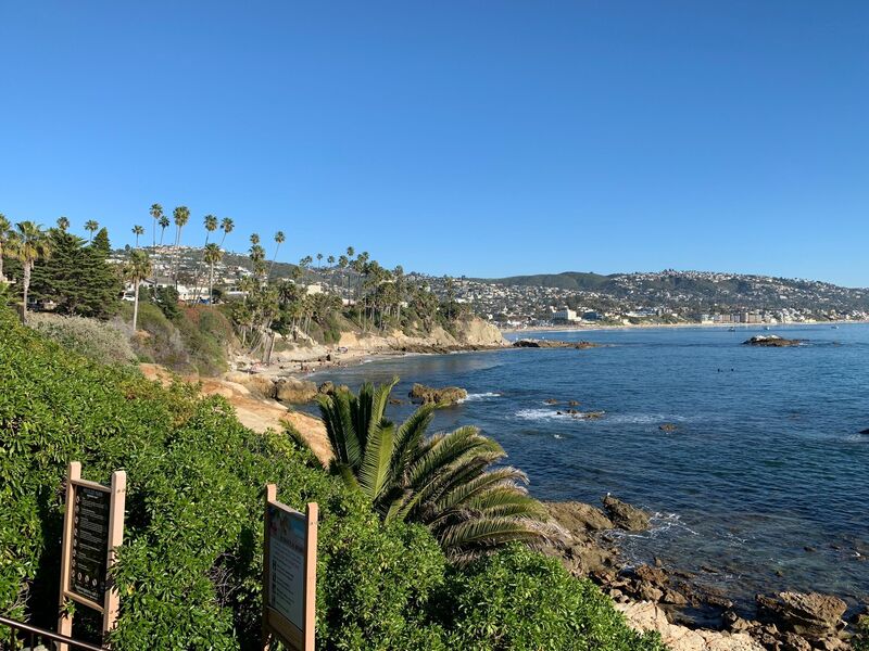
Image Source: AllTrails
- Location: Heisler Park
- Trail Length: 1.5 miles
- Trail Type: Out-and-back trail
- Trail Difficulty: Easy
- Estimated Time: ½ hour
The Laguna Beach and Bluffs Trail is a popular paved trail in Heisler Park. Along this trail, you’ll have beautiful coastal views and beach access. Heisler Park also features gardens, a marine refuge, lawn bowling greens, and an event venue.
This area is a popular spot that’s often crowded on weekends. Make sure to get here early during these busy hours. The Laguna Beach and Bluffs Trail is wheelchair-accessible and dog friendly. When you’re done with the hike, head down to the beach at one of the many access points. This is a great trail to try out a pair of hiking sandals!
Top of the World via Canyon Acres Trail
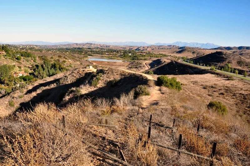
Image Source: California Crossroads
- Location: Aliso and Wood Canyons Wilderness Park
- Trail Length: 2.4 miles
- Trail Type: Out-and-back trail
- Trail Difficulty: Moderate
- Estimated Time: 2 hours
The Canyon Acres Trail is located in Laguna Beach within the Aliso and Wood Canyons Wilderness Park. The trail is moderately challenging and features steep climbs as you get to the top. This is the trail for you if you’re looking for a workout. Plus, the panoramic views of the hills and ocean are worth it!
The trailhead to Canyon Acres Trail has limited parking. If parking is complete at the main trailhead, you can take Alta Laguna Boulevard to go straight to the Top of the World to see the sweeping views without the challenging hike.
Start this trail early in the morning because there’s no shade throughout the path. Also, make sure to bring a hat and plenty of water in an iron or hydro flask to stay hydrated.
Bommer Ridge Trail
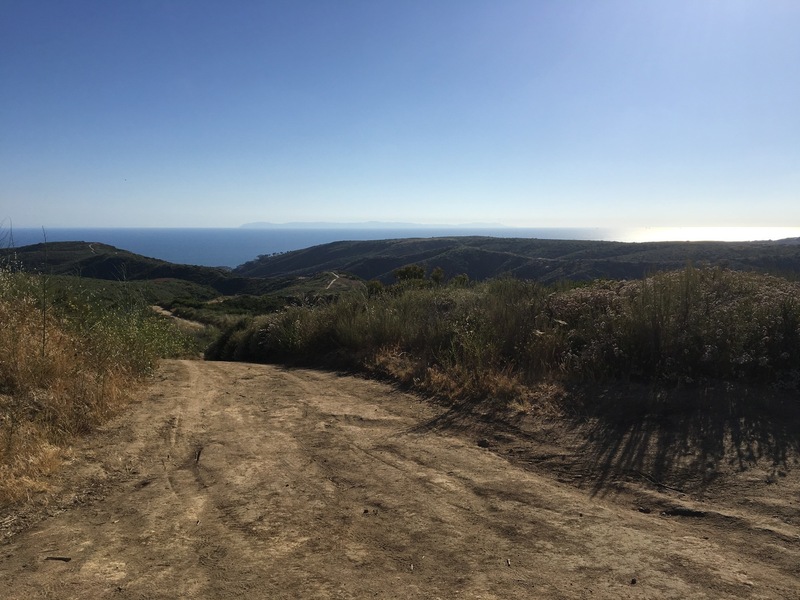
Image Source: MTB Project
- Location: Laguna Coast Wilderness Park
- Trail Length: 7.4 miles
- Trail Type: Out-and-back trail
- Trail Difficulty: Easy
- Estimated Time: 3 hours
The Bommer Ridge Trail is located in the Laguna Coast Wilderness Park. Although it’s a long trail, it’s considered a leisurely hike. You’ll have spectacular distant ocean views and coastal canyons along the way.
On average, the out-and-back trail takes about three hours to complete. It would be best if you planned to get an early start because it’s a hot and exposed area with limited shade. Keep in mind that dogs are not allowed on this trail. However, the Bommer Ridge Trail is family-friendly and great for mountain biking.
Crystal Cove Perimeter Loop
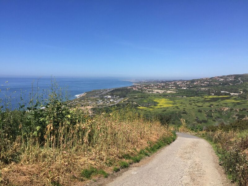
Image Source: AllTrails
- Location: Crystal Cove State Park
- Trail Length: 9.4 miles
- Trail Type: Loop trail
- Trail Difficulty: Moderate
- Estimated Time: 4 hours
Crystal Cove State Park is located in the beautiful coastal hills of Laguna Beach. The Crystal Cove Perimeter Loop is the longest trail in the park, and it’s considered moderately challenging. This trail has a considerable amount of elevation gain and boasts stunning views over the Pacific and east toward Santiago and Modjeska Peaks.
This tour of Crystal Cove passes all three backcountry campgrounds and takes you up and down ridges and valleys. If you’re interested in turning this hike into an overnight backpacking adventure, there are designated camping areas along the trail.
The Crystal Cove Perimeter Loop is family-friendly but doesn’t allow dogs. Parking is available at the trailhead by the El Morro Ranger Station, and a $ 15-day pass is required for each vehicle.
Mountain Hikes in Orange County
Carbon Canyon Nature Trail
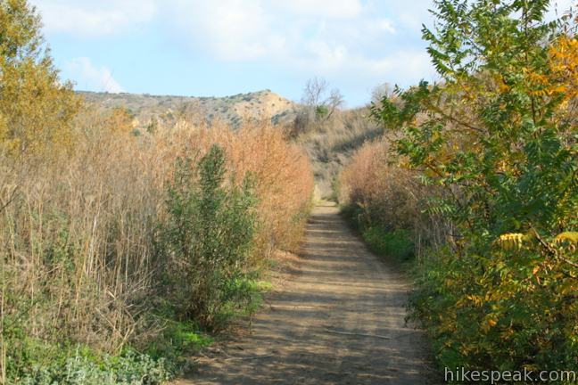
Image Source: Hikes Peak
- Location: Carbon Canyon Regional Park
- Trail Length: 3.1 miles
- Trail Type: Loop trail
- Trail Difficulty: Easy
- Estimated Time: 1 hour
The Carbon Canyon Nature Trail is a popular trail that takes you on a stroll to a 10-acre area with over two hundred stunning Coastal Redwood trees. If you’re looking for a fun nature walk for the whole family, this hike is for you! Enjoy the scenic stroll that feels like a Northern California Redwood Forest.
Hikers share the Carbon Canyon Nature Trail with bikers, so plan on listening for bells alerting you of their presence. In addition, at least two designated accessible spaces are in the paved parking lot off East Santa Fe Road at the trail’s north end.
Whiting Ranch Loop Trail
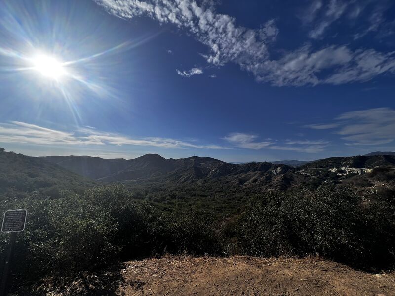
Image Source: AllTrails
- Location: Whiting Ranch Wilderness Park
- Trail Length: 5.9 miles
- Trail Type: Loop trail
- Trail Difficulty: Moderate
- Estimated Time: 2 ½ hours
Whiting Ranch Wilderness Park is an expansive park with trails designed for hikers of all abilities. It boasts many stunning oak and sycamore tree-filled red rock canyons, hilltops with 360-degree views, and windy single-track trails. The first 4 miles are flat, but the final mile offers some challenges with steeper, rocky, climbs.
The Whiting Ranch Loop Trail is well-marked and an easy hike. It’s a kid-friendly hike, so it’s a great trail to take the whole family on. However, the shade along the way is sporadic, so ensure you have plenty of water and sun protection!
Peter’s Canyon Loop Trail
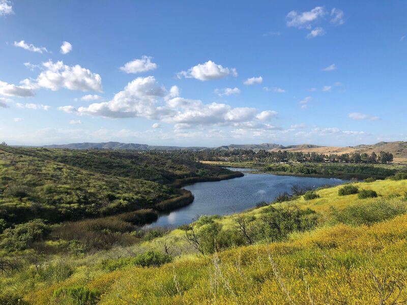
Image Source: AllTrails
- Location: Peters Canyon Regional Park
- Trail Length: 5.9 miles
- Trail Type: Loop trail
- Trail Difficulty: Moderate
- Estimated Time: 2 ½ hours
Peter’s Canyon Loop Trail is situated in the 340-acre Peters Canyon Regional Park in Orange County. Within this park are four natural habitats and two manufactured reservoirs that provide a home for an abundance of wildlife. This 6-mile loop trail offers a thorough tour of this stunning green space.
Parking fills up quickly at the trailhead, so be sure to arrive early. The Peter’s Canyon Loop trail is well-maintained, and a few steep hills are avoidable to make the path easier. However, remember that there isn’t enough shade, so bring sun protection and lots of water!
Aliso Creek and Wood Canyon Loop Trail
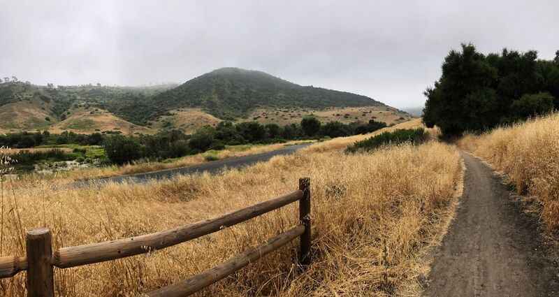
Image Source: AllTrails
- Location: Aliso and Wood Canyons Wilderness Park
- Trail Length: 10.5 miles
- Trail Type: Loop trail
- Trail Difficulty: Moderate
- Estimated Time: 4 hours
Aliso and Wood Canyons Wilderness Park is a popular area for birding, hiking, and horseback riding. While you’re hiking this loop trail, there’s a good chance you’ll run into other people while exploring. Be sure to leave your dog at home, as this trail isn’t dog-friendly.
Get ready for unique caverns, stunning meadows, and panoramic views on the Aliso Creek and Wood Canyon Loop Trail. You’ll start at the visitor center. While you’re there, check out the short native-flora loop for an educational warm-up section.
Waterfall Hikes in Orange County
Ortega Falls Ridge Loop
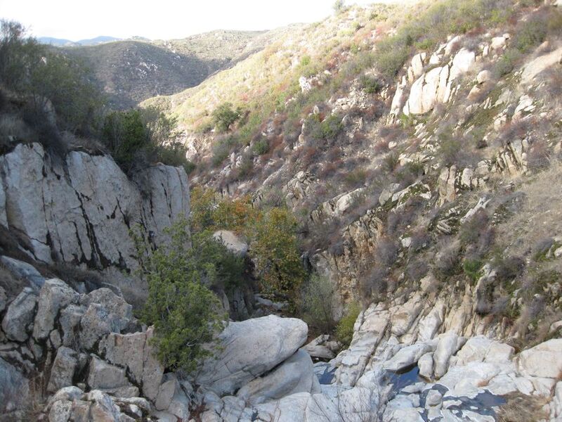
Image Source: The Hiker’s Way
- Location: Lake Elsinore, California
- Trail Length: .3 miles
- Trail Type: Loop trail
- Trail Difficulty: Easy
- Estimated Time: 15 minutes
The Ortega Falls Loop Trail is a fantastic adventure if you’re looking for an escape from the crowds of Newport Beach. Although the drive is almost an hour from Newport Beach, the stunning waterfall views are certainly worth it.
There are a few different routes to get to the waterfall. The easiest way takes you down to the bottom and then up to a smaller waterfall. Once you get to the mini waterfall with multiple graffiti pictures, keep climbing up. When you make it to the top of the rocks, you should be able to hear and see the magnificent falls.
Bring a picnic lunch to enjoy at the falls. Once you’re done enjoying the waterfall, go back to the rocks and climb down. Then, if you want more adventure, take the optional scramble back up.
Tenaja Falls
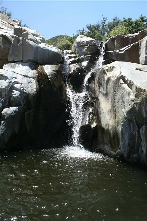
Image Source: Trip Advisor
- Location: San Mateo Canyon Wilderness
- Trail Length: 1.5 miles
- Trail Type: Out-and-back trail
- Trail Difficulty: Easy
- Estimated Time: 45 minutes
If you’re up for a drive through some beautiful southern California mountains, the Tenaja Falls hike is for you. This scenic drive passes by ranches, vineyards, avocado orchards, and citrus farms. Tenaja Falls is seasonal and flourishes after rainfall, but there is year-round water in the stream bed.
The hike to Tenaja Falls is a short, easy, well-marked trail. This makes it kid-friendly and suitable for hikers of any ability. Pack out a picnic lunch, or complete the drive in the evening to watch a magnificent sunset.
Black Star Canyon Falls Trail
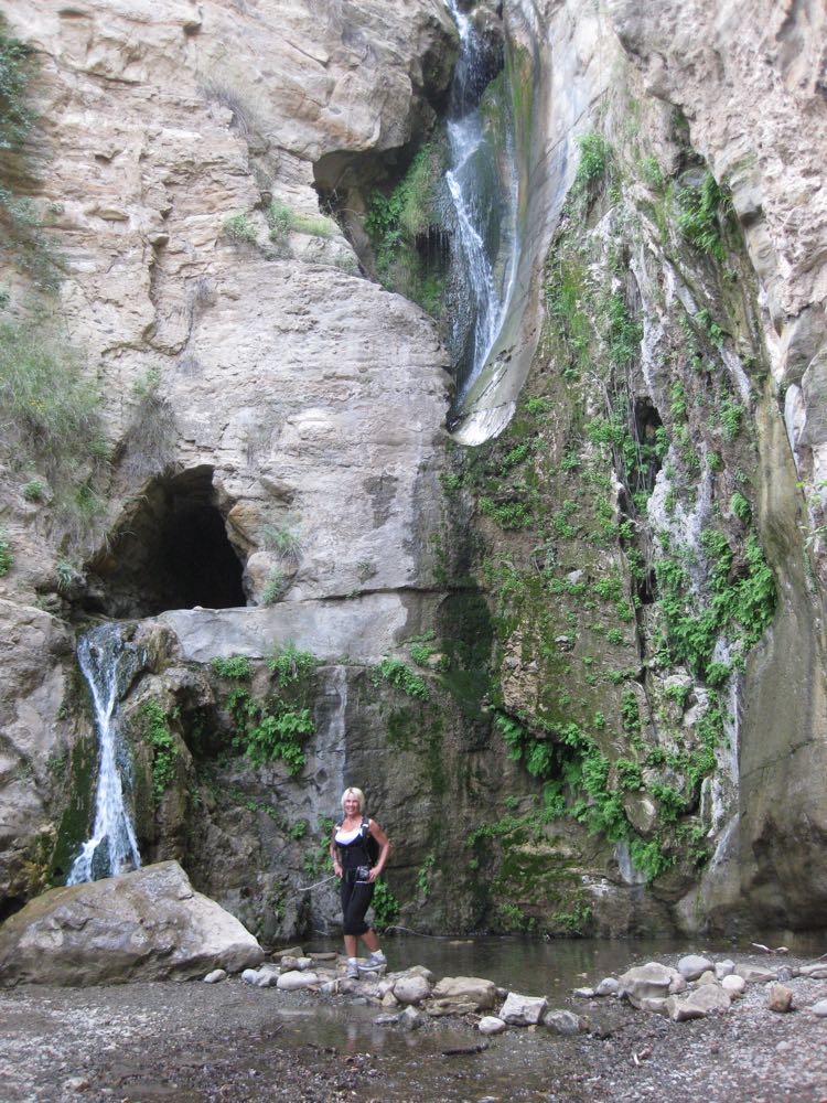
Image Source: The Hiker’s Way
- Location: Cleveland National Forest
- Trail Length: 6.7 miles
- Trail Type: Out-and-back
- Trail Difficulty: Hard
- Estimated Time: 3 hours
Black Star Canyon Falls Trail is the perfect route for hikers looking for adventure. This trail is nestled in the stunning Cleveland National Forest. The trail leads you along streambeds and over rocky terrain end eventually ends up at Black Star Canyon Falls.
Black Star Canyon Falls is a great hike for experienced hikers looking to practice their more technical scrambling skills. You may want to consider hiking this trail in approach shoes.
The grand finale Black Star Canyon Falls, is an incredible sight, especially if there is recent rainfall. To get to the trailhead, follow Santiago Canyon Road and turn onto Silverado Canyon Road. From there, turn left onto Black Star Canyon Road, and parking is at the end of the road.
Chiquito Falls Trail
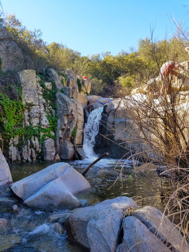
Image Source: Forest Service
- Location: Cleveland National Forest
- Trail Length: 9.1 miles
- Trail Type: Loop trail
- Trail Difficulty: Moderate
- Estimated Time: 4 ½ hours
Chiquito Falls is nestled deep in the heart of Cleveland National Forest. This trail is secluded and the perfect getaway from the crowds visiting the more famous San Juan falls. Chiquito is a season waterfall, so it doesn’t run all year. The best time to visit this area is during the rainier months.
The trailhead to Chiquito Falls is just down the road from Ortega Falls. Although the trail is long, it’s not technical or complicated. The route to the falls is a single track with some creek crossings along the way. Unfortunately, there isn’t much shade, so start this hike early and wear sunscreen!
Natural Hot Springs Hikes in Orange County
Upper Hot Spring Canyon to Falls Trail
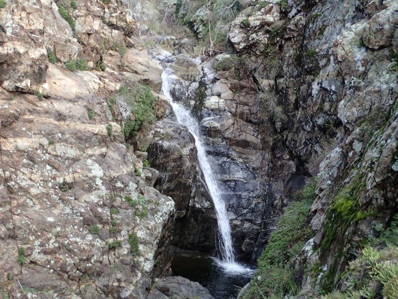
Image Source: The Hiker’s Way
- Location: Cleveland National Forest
- Trail Length: 3.6 miles
- Trail Type: Out-and-back trail
- Trail Difficulty: Moderate
- Estimated Time: 1 ½ hours
Hot Spring Canyon is one of the most remote and unexplored canyons in the Santa Ana Mountains. The trail can be moderately strenuous and features some steep climbs. However, the surrounding scenery is both stunning and unique. Along the way, you’ll pass by moss-covered granite cliffs, various cacti, and aquatic grasses.
The Falls Trail starts upstream at the headwaters, and as you hike down along Hot Spring Creek, the water flow will pick up as tributaries join the main creek. The stream can be dry during the summer, and the hike is more of a rock hop. But the river currents can be turbulent during the winter rains, making the granite treacherous. So be sure to hike with caution during these months!
San Juan Hot Springs via Juaneno Trail
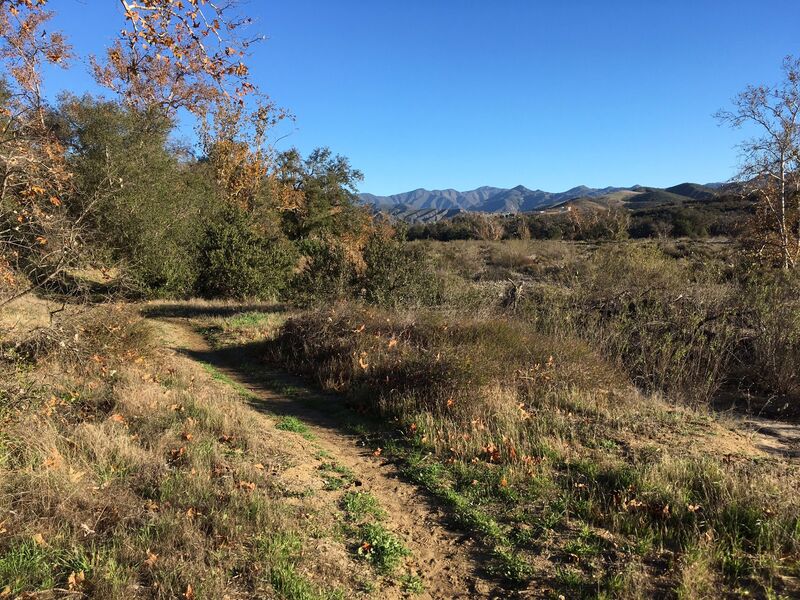
Image Source: AllTrails
- Location: Caspers Wilderness Park
- Trail Length: 10.6 miles
- Trail Type: Out-and-back trail
- Trail Difficulty: Moderate
- Estimated Time: 4 hours
The Juanito Trail is a fun hike to the San Juan Hot Springs, nestled in Caspers Wilderness Park. This 8,000-acre protected wilderness preserve is lightly-visited and nestled in the foothills of the Santa Ana Mountains.
The San Juan Hot Springs was first opened in the late 1800s as a full-blown resort with cabins, soaking tubs, and pools. The resort has closed and re-opened over the years, with the newest version being closed in 1992. Today you can still hike to the San Juan Hot Springs on the Juaneno Trail.
Orange County Hiking FAQs
How long is the Top of the World hike in Laguna Beach?
The hike to the Top of the World is 2.4 miles out and back.
What is the hardest hike in Southern California?
The hike to the peak of San Gorgonio is often considered the hardest hike in Southern California. It’s an 18.5-mile out-and-back hike with a total elevation gain of 5,957 feet.
When is the best time to go hiking in Orange County?
Winter is a great time to go hiking in Orange County because the weather is mild and generally warm. Hiking in the spring is also a great choice because there are usually fewer crowds and great weather.
Orange County is known for its city life and man-made attractions, but it also has many gorgeous natural spaces that are just as worthwhile to visit. The wide variety of hiking trails makes this area the perfect destination for any outdoor adventure. From challenging mountain hikes to secluded waterfalls to stunning coastal walks with ocean views, you can’t go wrong in Orange County!
Before you lace up your shoes and hit the trail, make sure you have the right gear for your hike. Check out our review of the best GPS Watch and hiking pants for some trail inspiration!


Leave a Reply