If you’re visiting upstate New York, there’s no way you can miss spending some time in the Catskill Mountains. With thousands of miles of scenic hiking trails to check out, the possibilities for fun and exploration are endless.
The Catskill Mountain range is situated between Albany and New York City in southeast New York. This area is composed of both public and private land. Catskill Park is 700,000 acres and occupies parts of four counties: Sullivan, Delaware, Greene, and Ulster.
No matter what kind of hiking adventure you’re looking for, you’ll be able to find it in the Catskills. If you want to hit some mountain summits, there are 98 peaks in the Catskills to choose from. If discovering remote waterfalls is more your style, there are plenty of options for you to explore.
You can enjoy the Catskill Mountains any time of year. There are endless opportunities to hike and mountain bike during the spring, summer, and fall. And when winter rolls around, the ski resorts in the Catskills open up for skiers, snowboarders, and snowmobilers.
The Catskill Mountains offer some of the most beautiful and diverse hiking in the Northeast, so it’s truly the perfect destination for well-seasoned and beginner hikers. We’ve chosen some of the best hikes in the Catskills for you to start planning your visit!
Table of Contents
Best Scenic Overlook Hikes
Hike to Giant Ledge
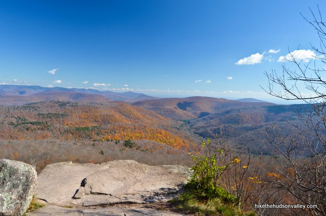
Image Source: Hike the Hudson Valley
- Location: Eastern Catskills
- Trail Length: 3.75 miles
- Trail Type: Out-and-back trail
- Trail Difficulty: Moderate
- Estimated Time: 1 ½ hours
Anyone here will tell you that the Giant Ledge hike offers the best views in all the Catskills! While it’s a moderately challenging hike with almost 1,000ft of elevation gain, there are five scenic overlooks along the trail where you can take a break and admire the spectacular views!
If you’re an experienced hiker looking for more of a challenge, you can extend your hike another 7 miles and take on Panther Mountain. With a 3,700-foot summit, this peak is sure to provide stunning vista views!
Balsam Lake Fire Tower via Dry Brook Ridge Trail
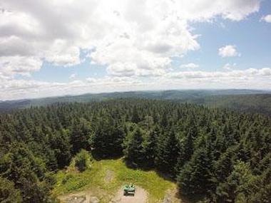
Image Source: New York State
- Location: Balsam Lake Mountain Wild Forest
- Trail Length: 4.3 miles
- Trail Type: Loop trail
- Trail Difficulty: Moderate
- Estimated Time: 2-3 hours
Take this hike to the Balsam Lake Fire Tower for panoramic you won’t want to miss! Balsam Lake Mountain is the 17th highest peak within the Catskills Mountain Range.
The fire tower is open to hikers only during summer for safety purposes. Balsam Lake Mountain is also common for winter adventurers to go snowshoeing and cross-country skiing, although the views from the top are limited without the fire tower.
This loop trail provides two turnoffs to the fire tower. There’s some elevation gain here, so be prepared for a challenge! The way down from the lookout is a steep and rocky descent, so be sure to use caution and take your time!
Hike to Sam’s Point
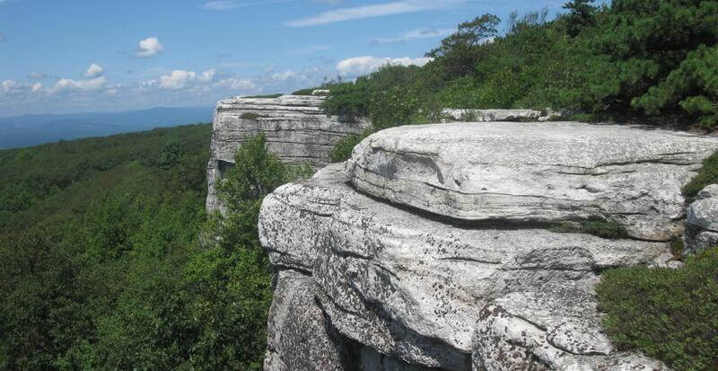
Image Source: NYNJ Trail Conference
- Location: Minnewaska State Park
- Trail Length: 7.5 miles
- Trail Type: Out-and-back trail
- Trail Difficulty: Moderate to hard
- Estimated Time: 3 hours
The hike to Sam’s Point is one of many in Minnewaska State Park, but the views from the top are anything but ordinary. This route boasts breathtaking views of the western Catskills. You’ll also get an aerial view of the 180-foot Verkeerderkill Falls.
A unique feature of Sam’s Point is the ice caves. Yes, you read that correctly! In the spring and summer months, you can wander through tight rock crevasses lined with ice leftover from the winter months.
The hike to Sam’s Point is long and can be challenging, so make sure you are prepared for a full-day hike.
Best Waterfall Hikes
Kaaterskill Falls
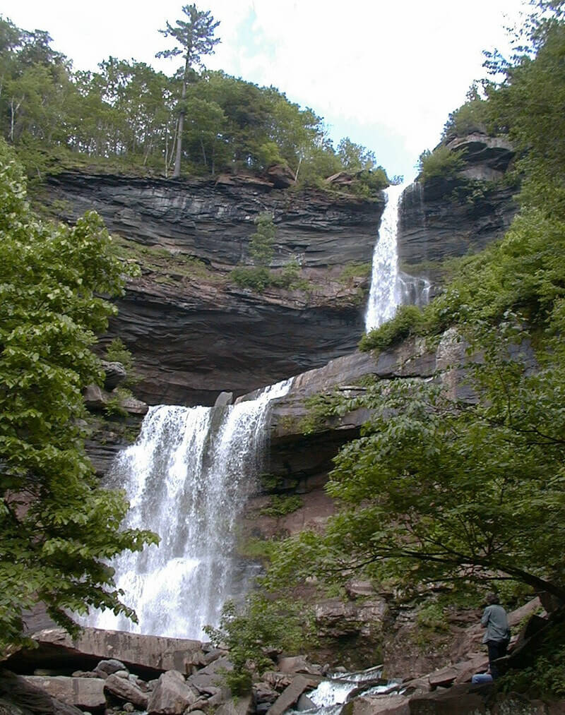
Image Source: Wikipedia
- Location: Laurel House Falls
- Trail Length: 2 miles
- Trail Type: Out-and-back trail
- Trail Difficulty: Moderate
- Estimated Time: 1 hour
This hike is for you if you’re looking for one-of-a-kind waterfall views! You’ll start your waterfall hike with expansive views of one of the most stunning scenes in the Catskills. These falls are a great place to relax for a picnic lunch or find inspiration for your next painting.
Kaaterskill Falls is an impressive 260-foot two-tier waterfall. It’s the tallest in New York State – higher even than Niagara Falls! Kaaterskill is the perfect destination for a day hike, and it features well-groomed trails and man-made stairs to make the hike more accessible. Even with this, the trail is steep, and you’ll still want sturdy shoes. You may even consider a pair of approach shoes.
Hike to North Point
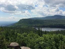
Image Source: Catskill Mountain Club
- Location: Windham-Blackhead Range Wilderness
- Trail Length: 3 miles
- Trail Type: Out-and-back
- Trail Difficulty: Moderate
- Estimated Time: 1-2 hours
The North-South Lake Campground is located in the Windham-Blackhead Range Wilderness and features plenty of hikes for all experience levels. Some of the shorter hikes will bring you to the Catskill Mountain House site with views of beautiful vistas.
The more moderate hikes take you higher up to places such as Boulder Rock, Sunset Park, and North Point. If you and your family are looking for a bit of a challenge with opportunities for waterfall views, the hike to North Point is for you!
The path to North Point passes by the stunning Ashley Falls before continuing uphill to North Point. There are many other viewpoints along the way to stop, relax, and enjoy the beauty of your surroundings.
Many hikers report that the trail often has streams running near or through it. Hiking shoes with good traction will be necessary for the wet rocks!
High Falls, Denton Falls, and Mullet Falls via Katarina Falls Trailhead
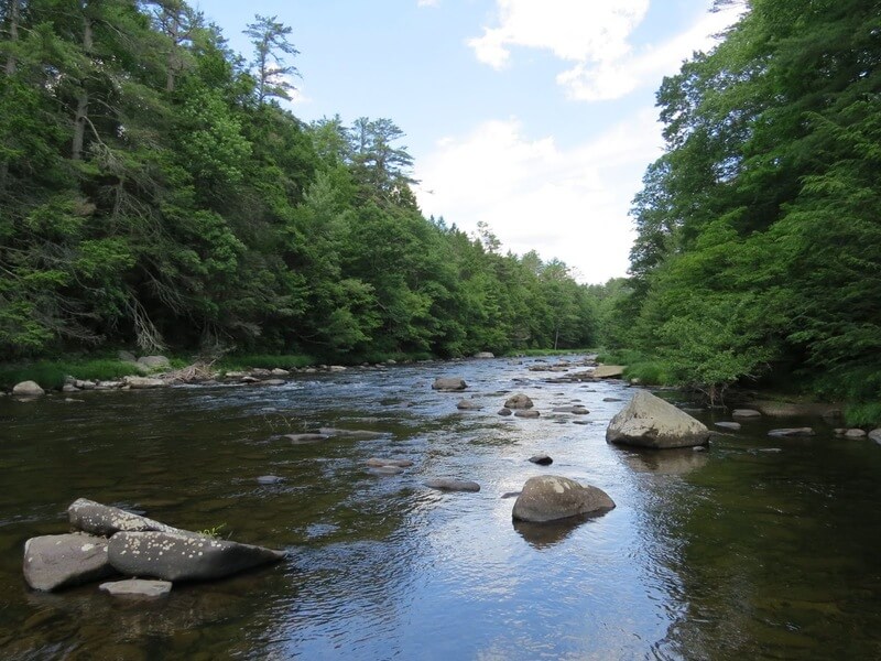
Image Source: HB Trails
- Location: Neversink River Unique Area
- Trail Length: 8.4 miles
- Trail Type: Loop trail
- Trail Difficulty: Moderate
- Estimated Time: 4-5 hours
According to the Nature Conservancy, the Neversink River Unique Area is one of the “Last Great Places in the US.” This area allows you to explore a stunning gorge, multiple waterfalls, and 6,500 acres of beautiful landscape.
In total, there are three main trails available that total 11 miles. To see what this place has to offer, we recommend taking the trail from the Katarina Falls Trailhead. From there, you’ll be able to access side trails to visit Mullet Brook Falls, Denton Falls, and High Falls.
From the parking lot, follow the blue blazes. Along the way, take the yellow foot trails down to the river and waterfalls. Once you hit the end of the blue blazes, turn around and return the same way until you hit the red blazes off to the right to finish the loop.
Best Family Hikes
Frick Pond Loop
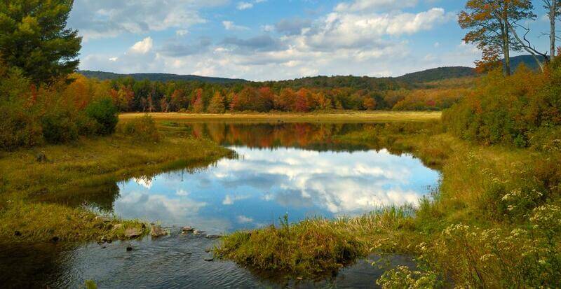
Image Source: NYNJ Trail Conference
- Location: Willowemoc Wild Forest
- Trail Length: 2.2 miles
- Trail Type: Loop trail
- Trail Difficulty: Easy
- Estimated Time: 1 hour
The Frick Pond Loop is considered one of the best family-friendly hikes in the Catskills for all ages. This loop trail travels through various terrain, including forests, meadows, and wetlands.
There are boardwalks in some of the wetland areas of the trail, but this can still be a muddy hike in spring or after heavy rains. Make sure you have studied hiking points on this trail.
The Frick Pond Loop trail offers many opportunities to see local wildlife, especially birds. The trailhead is located off Beech Mountain Road. Look for the Quick Lake and Flynn Trail Trailhead and follow the red blazes to complete the Frick Pond Loop.
Huckleberry Trail
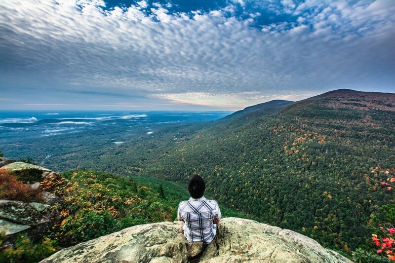
Image Source: Scenic Hudson
- Location: Catskill Park
- Trail Length: 4.5 miles
- Trail Type: Out-and-back
- Trail Difficulty: Moderate
- Estimated Time: 2 ½ hours
Huckleberry Trail is an excellent route for hikers of any and all skill levels. Because it’s relatively short and not too challenging, beginner hikers can also enjoy this trail. There are some steep sections that may feel challenging, but the stunning views at the end are well worth it!
Throughout this hike, you will walk by streams, forested pine trees, and some short, steep ascents. If you go on a rainy day, be aware that the streams may be difficult to pass. And if you go during the summer, at the summit, you will see and smell lots of huckleberry bushes!
From the trailhead, follow the blue blazes up the hill. Then, follow the Yellow Trail sign to the right and take the yellow blazes up to the top. When you reach Huckleberry Point, you will know it right away! From the top, you can see the Catskills on your right and the Hudson River in the distance on your left.
Ashokan Rail Trail
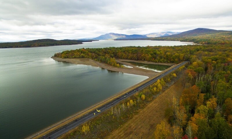
Image Source: Ashokan Rail Trail
- Location: Catskill Park
- Trail Length: 11.5 miles
- Trail Type: Out-and-back
- Trail Difficulty: Easy
- Estimated Time: 3-4 hours
The Ashokan Rail Trail is an easy walk with stunning water views. The trail is open year-round from sunrise to sunset. It’s a perfect route for families with young children and ADA-compliant and accessible for persons with disabilities.
This trail is mostly shaded, and there are benches along the way to take breaks and enjoy the landscape. Don’t forget to check out the Esopus People and Ancestral Land information board to learn about the Indigenous community of this area.
The Ashokan Rail Trail runs along the Ashokan Reservoir between Basin Road in West Hurley and Route 28A in Boiceville, New York. This trail provides public access to the county’s scenic abandoned Ulster & Delaware Railroad corridor, which was constructed in 1911.
There are three trailheads along this 11.5-mile trail. However, we suggest starting at the Ashokan Station Trailhead. Beginning here will allow you to enjoy the best views, even if you don’t finish the whole trail.
Best Difficult Hikes
Overlook Mountain
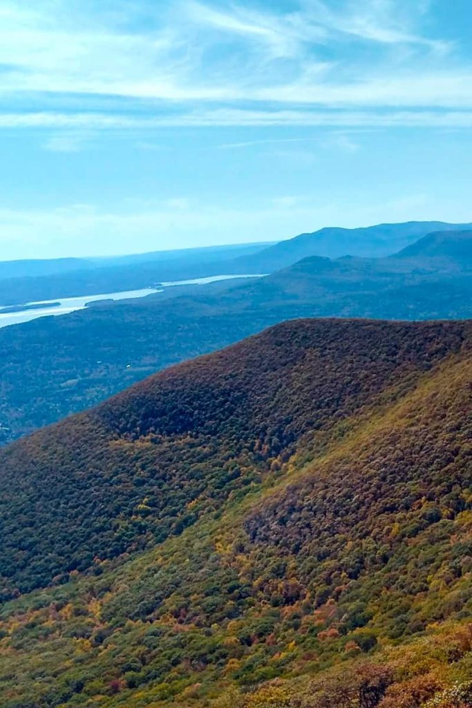
Image Source: Champagne Tastes
- Location: Catskill Mountains
- Trail Length: 5 miles
- Trail Type: Out-and-back
- Trail Difficulty: Hard
- Estimated Time: 2 hours
The trail to the summit of Overlook Mountain takes you along all of the best views in the Hudson Valley. You’ll hike on a wide, clear, and primarily paved trail from start to finish. The route to Overlook Mountain is one of the most popular hikes in the Catskills, so expect to see many people while you’re out there!
Some of the more popular features of this trail are the Buddhist temple across from the trailhead, old hotel ruins, and a fire tower at the summit. The Overlook Mountain fire tower provides you with some of the most spectacular views of the Hudson Valley!
This is considered a strenuous hike, so ensure you’re well-prepared with hiking experience and proper gear. The parking lot has limited space, so get an early start to beat the crowds!
Hike to Hunter Mountain Fire Tower
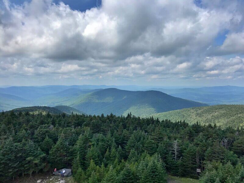
Image Source: Outdoor Fest
- Location: Catskill Park
- Trail Length: 8.2 miles
- Trail Type: Loop trail
- Trail Difficulty: Hard
- Estimated Time: 4 hours
The Hunter Mountain Fire Tower is considered one of the Catskills’ most challenging treks. Standing at 4,040 feet, Hunter Mountain is the most difficult of the five fire tower hikes in Catskill Park.
But don’t let that scare you- the reward from the top is well worth the challenging journey! After a steep climb to the summit, ascend the fire tower for incredible 360-degree views of the valley below. On a clear day, you’ll have views of Massachusetts, Connecticut, and Vermont.
After taking in these beautiful views, continue another 3.5 miles on Hunter Mountain Loop to enjoy a lovely night camping at the John Robb shelter. To access this trail, you can park at the DEC parking lot at the end of Spruceton Road.
Dry Brook Ridge Trail
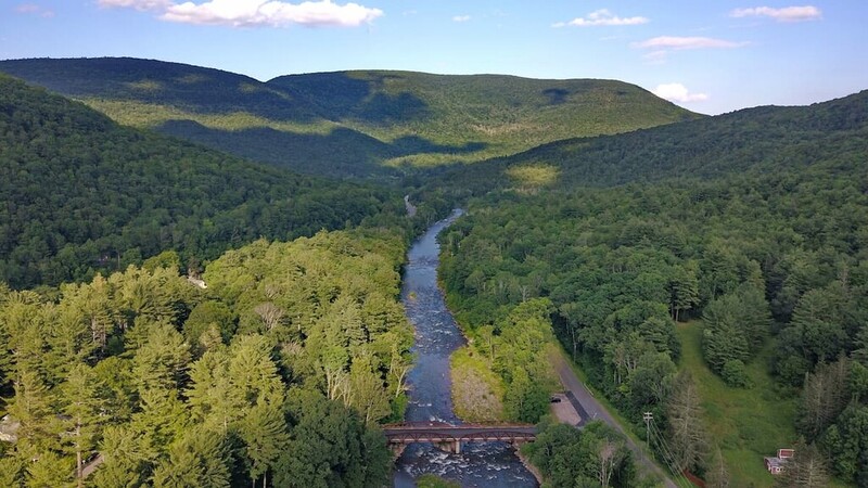
Image Source: Peak Visor
- Location: Catskill Park
- Trail Length: 13.6 miles
- Trail Type: Point-to-point Trail
- Trail Difficulty: Hard
- Estimated Time: 7-8 hours
Some of the most rugged places within the Catskills are in the Dry Brook Ridge Wild Forest. Because it’s located in one of the less popular sections of the Catskills, the Dry Brook Ridge Trail allows you to experience peace and solitude.
The Dry Brook Ridge Trail is 13.6 miles, and it runs from Margaretville to the Balsam Lake parking area. If you plan to take on this hike, make sure you come prepared with sturdy hiking shoes and previous experience! The trail can be steep and challenging at some points.
The trail begins by climbing an old logging road. You’ll then summit the stunning Pakatakan Mountain, standing at 2,500 feet, about two miles in. After about 5 miles, the trail takes you around Dry Brook Ridge with spectacular views to the west.
Near the end of this trail is the summit of Dry Brook Ridge, standing at 3,460 feet. The trail ends at 13.6 miles at the Balsam Lake Mountain Parking Area in the Balsam Lake Mountain Wild Forest.
Catskill Hiking FAQs
Where is the best place to hike in Catskill Park?
Of course, you can’t go wrong hiking any of these trails we listed in the Catskills. However, one of the top-rated trails is Giant Ledge. Many argue that the best views in the Catskills can be seen from the top of this ledge.
What is the longest trail in Catskill Park?
The longest trail in Catskill Park is Devil’s Path East to West. This trail is estimated to be 24 miles long and takes, on average, 15 1/2 hours to hike.
What is the hardest hike in the Catskills?
Devil’s Path is considered the hardest hike in the Catskills and one of the country’s hardest hikes. In total, there are over 14,000 feet of total ascent.
Conclusion:
It’s no wonder the Catskill Mountains are a popular outdoor adventure destination. The incredible landscapes and unique natural features set it apart from other beautiful parts of the state of New York.
Before you set out on the trail, ensure you’re prepared with all hiking essentials, such as a durable day pack, sturdy hiking boots, and quality hiking pants. You may even consider a GPS watch for longer and more remote hikes.
Whether you embark on a challenging solo backpacking trip or a leisurely stroll with your family, hiking in the Catskills will leave you feeling accomplished and in touch with the beauty of your surroundings.


Leave a Reply