Joshua Tree is a fascinating national park with so much to offer its visitors. Not only does it provide incredible landscapes, but it also holds a deep human history of those who inhabited the land first.
Joshua Tree features a wide variety of stunning hikes with varying degrees of difficulty. You really can’t go wrong with any of these Joshua Tree hiking trails. Are you ready to traverse through the beautiful desert terrain full of unique desert plant life? Use this as your guide to the best hikes in Joshua Tree National Park!
Table of Contents
- 1 Popular Hiking Trails in Joshua Tree National Park
- 2 One-of-a-Kind Hiking Trails in Joshua Tree
- 3 Hiking in Joshua Tree FAQs
- 3.1 What is the hardest hike in Joshua Tree?
- 3.2 What should you not miss in Joshua Tree?
- 3.3 What is the best Joshua Tree campground?
- 3.4 Do you need a permit to hike in Joshua Tree?
- 3.5 Is Joshua Tree National Park open for hiking?
- 3.6 Why is Joshua Tree National Park called “Joshua Tree”?
- 3.7 When is the best time to visit Joshua Tree?
- 3.8 Can I take a dog hiking in Joshua Tree?
- 3.9 How do I get a Joshua Tree trail map?
- 3.10 Do I need hiking shoes for Joshua Tree?
- 3.11 Are there stores or restaurants inside Joshua Tree National Park?
Popular Hiking Trails in Joshua Tree National Park
Ryan Mountain Trail
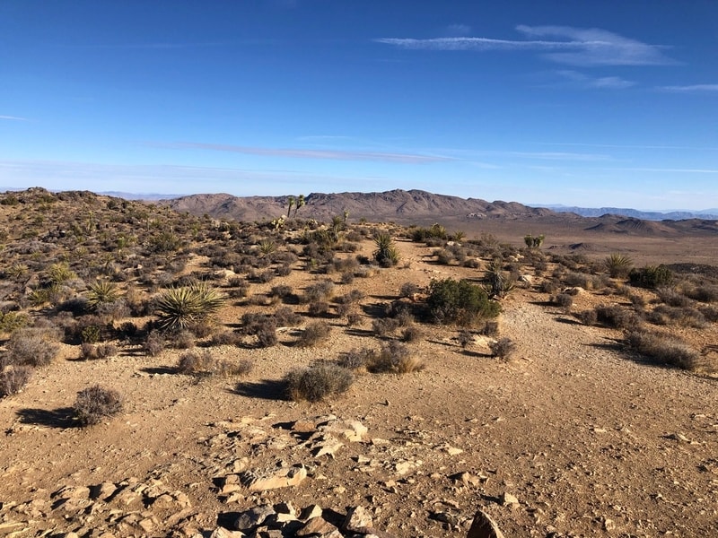
Photo Source: AllTrails
- Location: Twentynine Palms
- Trail Length: 3 miles
- Trail Type: Out & Back
- Trail Difficulty: Difficult
- Estimated Time: 2-3 hours
Trail Summary
The trailhead for Ryan Mountain is located on Park Boulevard in the heart of Joshua Tree National Park. While you only have the short distance of 1.5 miles one way, you’ll encounter about 1,070 feet of elevation gain. Be ready for a workout! Keep in mind that Ryan Mountain Trail is one of the most popular trails in Joshua Tree, so make sure to get an early start to beat the crowds.
The trail is a sun-exposed dirt path that features numerous stone steps and plenty of beautiful views along the way. All of your hard work definitely pays off at the top of the 5,457-foot Ryan Mountain. From the top, you have 360-degree views of Joshua Tree National Park! Many people choose to hike this trail in the evening for a magnificent sunset view. Be sure to grab some headlamps for a nighttime descent if you choose to do this!
There’s a turnoff for the Ryan Mountain trailhead on Park Boulevard about 2 miles east of the intersection of Keys View Road. There is a large parking area and a bathroom at the start of the trail.
Hidden Valley Nature Trail
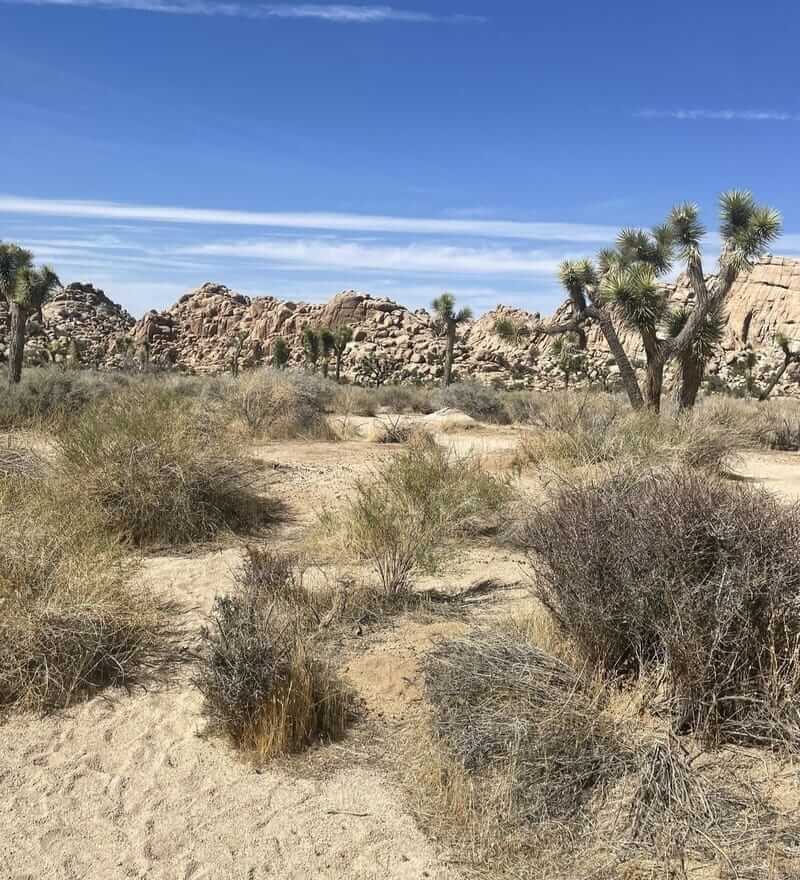
Photo Source: AllTrails
- Location: Twentynine Palms
- Trail Length: 1 miles
- Trail Type: Loop
- Trail Difficulty: Easy
- Estimated Time: ½ hour – 1 hour
Trail Summary
This easy 1-mile loop nature trail is a great introduction to all that Joshua Tree has to offer! The trailhead for Hidden Valley Trail is located just off of Park Boulevard and circles a small valley surrounded by large boulders. Hidden Valley Nature Trail is a great option for hikers of any skill level.
There are many signs along the nature trail to help you identify Joshua Tree’s plants and animals. The trail is mostly level with an easy grade, and it crosses through some hard-packed sand and numerous giant boulders.
If you enjoy rock climbing, this trail is for you! Along the Hidden Valley Nature Trail are plenty of opportunities for bouldering or just a good rock scramble. There’s a picnic area next to the parking lot that’s often shaded by some large boulder formations nearby. Hidden Valley Campground is also nearby. It features 39 sites and is a popular basecamp for day hikers and climbers.
The trailhead for Hidden Valley Nature Trail is just south of the Hidden Valley picnic and parking area and campground.
Barker Dam Nature Trail
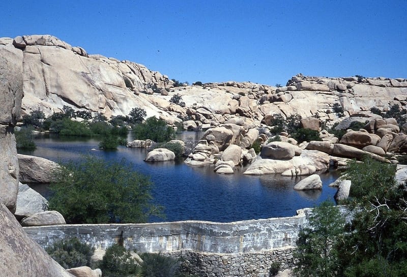
Photo Source: Wikipedia
- Location: Joshua Tree
- Trail Length: 1.3 miles
- Trail Type: Loop
- Trail Difficulty: Easy
- Estimated Time: 1 hour
Trail Summary
The Barker Dam Nature Trail is a mild yet exciting day hike that’s perfect for the whole family. This loop trail visits the reservoir, Barker Dam, within the Wonderland of Rocks in Joshua Tree National Park. The water may completely disappear in the dry summer months, so it’s best to visit this trail in the winter and spring.
This nature loop also features a bit of history. Barker Dam was built over a century ago by local ranchers to preserve the precious water in the desert landscape. Also along the Barker Dam Nature Trail is a marked turnoff that leads you to a boulder covered in petroglyphs made by the Native American people.
The turnoff for Barker Dam Nature Trail is on Park Boulevard about 12 miles west of the intersection with Pinto Basin Road. This trailhead is located near the west end of an unpaved road that crosses through Joshua Tree from Desert Queen Mine.
Skull Rock Nature Trail
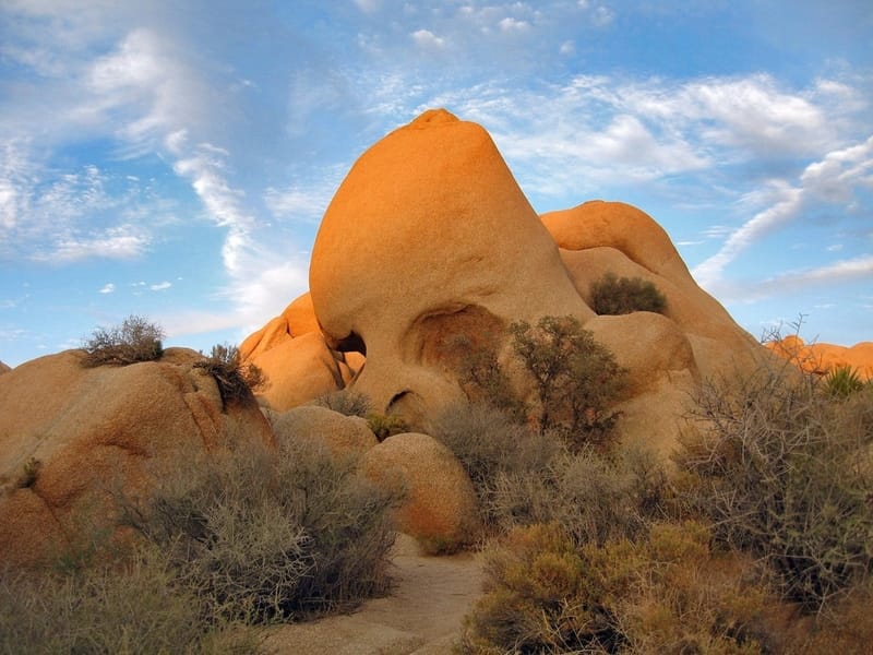
Photo Source: National Park Service
- Location: Twentynine Palms
- Trail Length: 1.8 miles
- Trail Type: Loop
- Trail Difficulty: Easy
- Estimated Time: 1 ½- 2 hours
Trail Summary
You won’t want to miss the stunning desert wildflower bloom along the Skull Rock Nature Trail each spring! This trail also features many other desert plants such as the Mojave yucca cacti and Pinyon pines.
As you depart from the trailhead, you’ll pass through some amazing rock formations with about 0.5 miles of walking along the paved campground road. There are also informative placards along the trail that explain the desert floor terrain and identify plants and animals that make up the desert ecosystem.
If you don’t want to do the full trail, you can also hike from Skull Rock through the Jumbo Rocks area. Then you can turn around upon reaching the campground. This out-and-back route is 1-mile roundtrip.
The trailhead for Skull Rock is off of Park Boulevard near the Jumbo Rocks Campground on the Twentynine Palms side Joshua Tree. There is parking on both sides of the road, but keep in mind it will fill up in the spring and on the weekends.
Fortynine Palms Oasis Trail
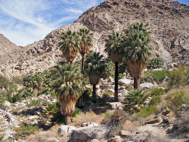
Photo Source: The American Southwest
- Location: Twentynine Palms
- Trail Length: 3 miles
- Trail Type: Out & Back
- Trail Difficulty: Moderate
- Estimated Time: 2 hours
Trail Summary
The Fortynine Palms Oasis Trail is a 3-mile round trip adventure. It takes you to a scattering of palm trees surrounding a rare desert spring. This Palms Oasis Trail is the perfect destination for just about any day hiker! And it’s just about the only place in the desert where you’ll find plenty of water. This might just become one of your new favorite hikes!
As you continue along the trail, you’ll climb upward and encounter panoramic views of the valley and Fortynine Palms Canyon. The trail then follows several ridges up and down before finally reaching the wet oasis surrounded by palm trees. These palm trees were planted by miners to mark the spring that now irrigates the trees. Bring a picnic lunch and sit beside the small pools of water to reward your efforts on the hike.
To get to the Fortynine Palms Oasis trailhead, you will turn onto a small dirt road, Canyon Road, just off of Twentynine Palms Highway. This trail is free to access as no permit is required for the hike to Fortynine Palms Oasis.
Arch Rock Nature Trail
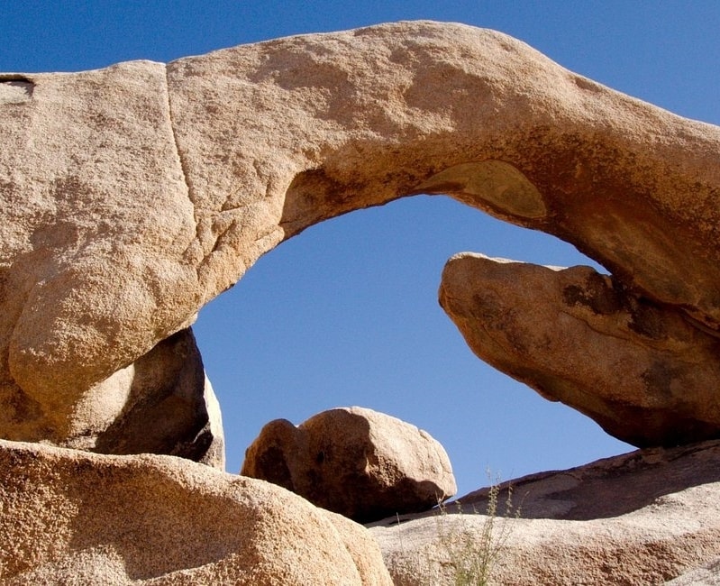
Photo Source: Trip Advisor
- Location: Twentynine Palms
- Trail Length: 1.2 miles
- Trail Type: Out & Back
- Trail Difficulty: Easy
- Estimated Time: ½ – 1 hour
Trail Summary
This is an easy and family-friendly trail that takes you to the natural arch feature within Joshua Tree National Park: the aptly named Arch Rock. It’s also one of the more popular hikes in Joshua Tree. If you’re camping at White Tank Campground, it’s just a short 0.3-mile loop hike to Arch Rock within the granite formations surrounding it. If you’re visiting Joshua Tree National Park, you can take a 1.3-mile lollipop loop hike that begins from a trailhead along Pinto Basin Road.
The Arch Rock Nature Trail is a single-track that features a side-view of Arch Rock. Just a few steps off trail puts you right below the rock span, so you can climb right up and touch it! Arch Rock spans about 30-feet across. Some people say that it’s shaped like a brontosaurus. It’s truly a fascinating rock formation!
It’s important to note that there are not any designated accessible spaces in the paved parking lot off of Pinto Basin Road at the west end of the trail. So, you have to park your car at the Twin Tanks Backcountry Board and Arch Rock Nature Trail parking lot.
One-of-a-Kind Hiking Trails in Joshua Tree
Wall Street Mill Trail
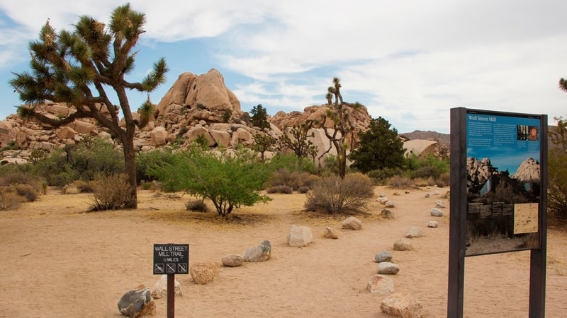
Photo Source: National Park Service
- Location: Twentynine Palms
- Trail Length: 2.4 miles
- Trail Type: Out & Back
- Trail Difficulty: Easy
- Estimated Time: 1- 1 ½ hours
Trail Summary
Experience a wide variety of mining history as you meander along this unmarked hiking trail to an old mill site. It’s an easy and level trail with plenty of cool rock formations and desert flora along the way.
When you reach the end of the trail, you’ll see the homestead of Wonderland Ranch and Wall Street Mill that are still standing. There are also several old rusted cars around the area. In the early 1900s, the desert landscape that’s now Joshua Tree National Park used to be scattered with miners on the hunt for gold. After the ore was mined, it was sent to a mill to have the gold extracted. Today, the Wall Street Mill is considered the best-preserved gold mill in Joshua Tree. It’s also listed in the National Register of Historic Places
The Wall Street Mine Trail has almost no shade and no cell reception. With this in mind, plan to check the weather forecast before heading into Joshua Tree National Park. Consider changing your plans if the weather conditions are too extreme. And always pack some extra water!
You’ll find the trailhead for the Wall Street Mill Trail just east of the Barker Dam area. It’s next to a dirt parking lot off of Queen Valley Road.
Cholla Cactus Garden Trail
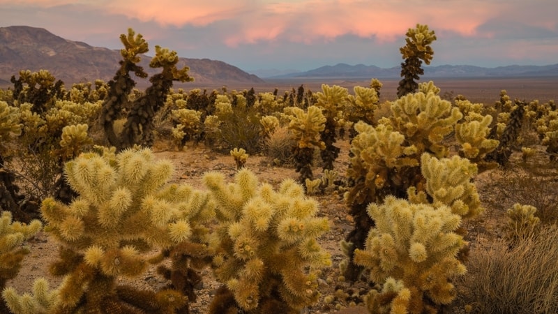
Photo Source: National Park Service
- Location: Twentynine Palms
- Trail Length: .25 miles
- Trail Type: Loop
- Trail Difficulty: Easy
- Estimated Time: ½ hour
Trail Summary
This quarter-mile hiking trail features a Cholla Cactus Garden along the Pinto Basin Road. It’s located on the merger between the Colorado and Mohave Deserts. This transition zone provides the Cholla cacti with plenty of water to support a large amount of them in one area.
The Cholla cacti are known as the cutest species of cacti out there, and they’re often referred to as the “teddy bear cactus”. But here’s a fun cacti fact! The Cholla cacti are known to “jump” from a parent cacti plant or the ground onto the skin or clothing of a passing hiker. That’s one teddy bear you don’t want to hug!
The Cholla Cactus Garden is the main attraction on Pinto Basin Road on the way to Cottonwood Spring. From Park Boulevard, take Pinto Basin Road for 12 miles. The Cholla Cactus Garden Trail begins on the south side of the road.
Lost Horse Mine Loop Trail
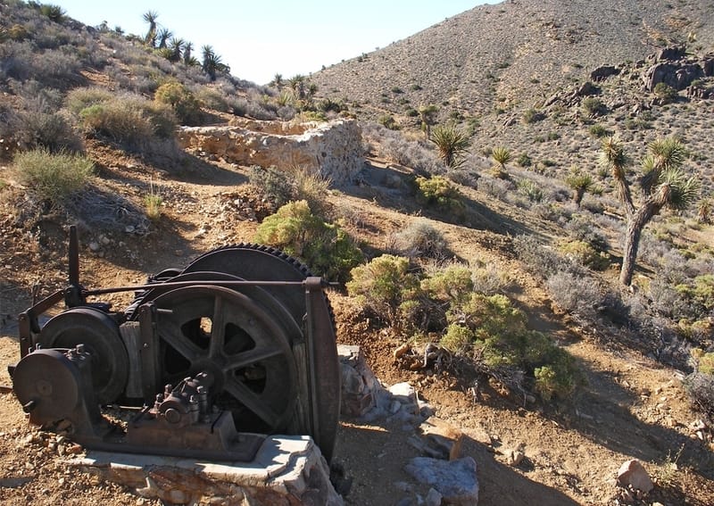
Photo Source: The American Southwest
- Location: Twentynine Palms
- Trail Length: 6.8 miles
- Trail Type: Loop
- Trail Difficulty: Moderate
- Estimated Time: 3-4 hours
Trail Summary
While Joshua Tree National Park is usually jam-packed with visitors, the Lost Horse Mine Loop Trail is a secluded and peaceful hiking trail away from the hustle and bustle. Along the trail, you’ll see plenty of Joshua and yucca trees. The surrounding landscape comes particularly alive during peak wildflower season.
The mill and foundation of Lost Horse Mine stand at the end of a gradual 4-mile round trip trail. Lost Horse Mine has one of the best-preserved mills under National Park protection. This mine was one of the few mineral speculations inJoshua Tree National Park to be productive. According to the National Park Service, the mine produced about 10,000 ounces of gold and 16,000 ounces of silver.
If you take the loop clockwise from the trailhead starting at the parking lot, it’ll be an easier hike. If you’re up for more of a challenge, head out the opposite direction. Either way, it’s recommended that you do the entire loop! Many day hikers go to the Lost Horse Mine and then turn around, but they miss out on some pretty incredible views!
To get to the trailhead for Lost Horse Mine, take Keys View Road from Park Boulevard south about 2.5 miles and turn left onto a dirt road.
Hiking in Joshua Tree FAQs
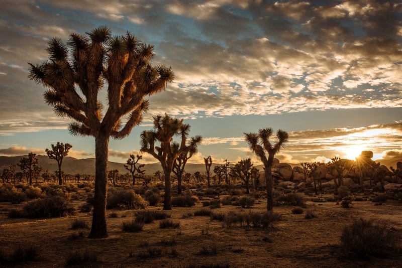
Photo Source: Unsplash
What is the hardest hike in Joshua Tree?
Ryan Mountain Trail is considered to be the most difficult hiking trail in the park. But don’t be discouraged- if you’re up for one of the more strenuous hikes, the view from the top is worth it!
What should you not miss in Joshua Tree?
Visit Skull Rock, climb around the Wonderland of Rocks, hike out to Arch Rock, walk through the Cholla Cactus Garden. Take the Hidden Valley Nature Trail.
What is the best Joshua Tree campground?
Hidden Valley Campground is rated the best campground in Joshua Tree National Park. Get your reservations in early because the sites fill up quickly on the weekend during the peak season cooler months!
Do you need a permit to hike in Joshua Tree?
A permit is not required for day hiking in the backcountry at Joshua Tree. If you want to backcountry camp, you have to park and register at a backcountry registration board. There’s no fee, and your permit is your reservation.
However, you do need to buy a parking pass to enter the Joshua Tree National Park. You can buy a digital park entrance pass on Recreation.gov. If you want to buy a pass in person, you can find them at the following entrances:
- North Entrance Station (near the city of Twentynine Palms): card only
- West Entrance Station (near the town of Joshua Tree): card only
- Joshua Tree Visitor Center: cash or card
- Oasis Visitor Center: cash or card
- Cottonwood Visitor Center: cash or card
Is Joshua Tree National Park open for hiking?
Joshua Tree is open year-round and 24 hours a day. The busy season runs from October through May, and the park slows down during the summer months.
Why is Joshua Tree National Park called “Joshua Tree”?
It’s called Joshua Tree because of the abundance of its namesake tree. The Joshua tree, or Yucca brevifolia, is native to the desert ecosystem ad landscape of the Mojave Desert.
When is the best time to visit Joshua Tree?
The best times to visit Joshua Tree National Park are from March to May and October to November. The temperatures are most comfortable in the spring and fall where temperatures average in the mid-80s during the day and 50s at night. And if you visit in the spring months, you’ll get to see an incredibly beautiful wildflower bloom!
Can I take a dog hiking in Joshua Tree?
Dogs are not allowed on any of the trails in Joshua Tree National Park. However, they’re allowed on unpaved roads within the park.
How do I get a Joshua Tree trail map?
You can find downloadable trail maps of Joshua Tree National Park on the National Park Service website. Here you can also find maps of the park campgrounds, backcountry campsites, and equestrian trails!
Do I need hiking shoes for Joshua Tree?
Yes, closed-toed hiking shoes are a must! There are lots of cacti and loose spines in the desert and you’ll want to protect your feet! They will also provide you with better traction on the terrain within Joshua Tree.
Are there stores or restaurants inside Joshua Tree National Park?
There are no stores or restaurants within Joshua Tree, but there are nearby towns that provide these services. Check out what’s available through their Chamber of Commerce websites.


Leave a Reply