If you know anything about Boston, Massachusetts, you probably know about the city’s rich history and culture. And if you’ve spent any time here, you know there’s something special about the charming city- even if you can’t quite put your finger on it.
But did you know that Boston is also an incredible travel destination for outdoor recreation? With miles of trails featuring stunning views in and surrounding the city, you’ll never run out of trails to explore. In addition, the wide variety of hiking trails means something out there for everyone, no matter your interest.
Many interpretive trails teach you about the city’s deep history. And the plentiful nature trails that boast spectacular views remind you to stop and enjoy the beauty that surrounds you. If you’re feeling adventurous, you can climb up to the scenic viewpoints with 360-degree views of the surrounding vistas and the city below.
Here are some of the best hikes near Boston.
Table of Contents
Easy Hikes Near Boston
Black Heritage Trail
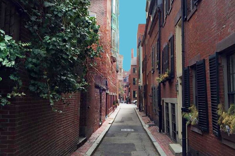
Image Source: Old Town Trolley
- Location: Beacon Hill
- Trail Length: Approximately 1.5 miles
- Trail Type: Point-to-point trail
- Trail Difficulty: Easy
- Estimated Time: 1 ½ hour
The south side of Beacon Hill is a historical area known for its rows of stunning brick homes once owned by the Boston elite. Comparatively, the north slope of Beacon Hill, where the Black Heritage Trail is located, has a long history of being a neighborhood of immigrants dating back to the early 1800s. It was also an active part of the Underground Railroad before the Civil War.
The Black Heritage Trail is an excellent hike for you if you’re looking for a history lesson while strolling through the city. While walking along this famous trail, it’ll lead you to the Boston African American National Historic Site. You’ll walk by 15 pre-Civil War homes, schools, businesses, and churches that belonged to the African American community in the 1800s.
You can lead yourself on a self-guided along the Black Heritage Trail. National Park Service Rangers also provide a free guided tour from April through November.
Freedom Trail
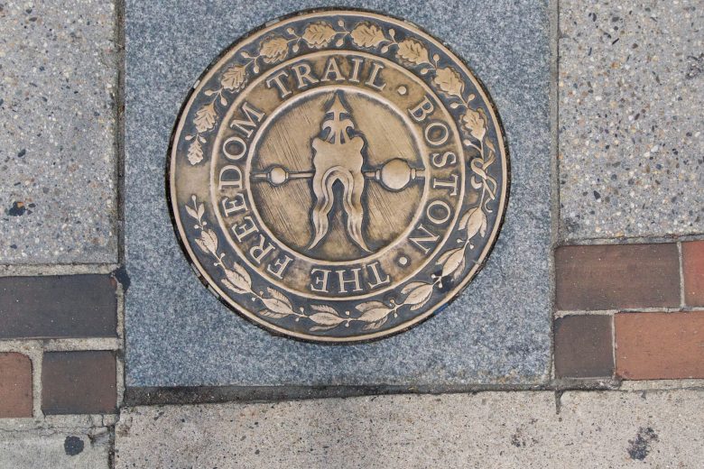
Image Source: New England Today
- Location: Downtown Boston, Massachusetts
- Trail Length: Approximately 2.5 miles
- Trail Type: Point-to-point trail
- Trail Difficulty: Easy
- Estimated Time:
A stroll along The Freedom Trail will give you the authentic Boston experience. The path of the Freedom Trail is marked with red brick and golden markers. The Freedom Trail is one of many great paved trails in Boston. This urban trail leads you right through downtown Boston. Along the way, you’ll pass by 16 historic locations. These are iconic Boston destinations such as Paul Revere’s House, the USS Constitution, and Faneuil Hall.
You can lead yourself along The Freedom Trail by using a map and following the red brick path. But if you’d prefer a more educational hike, there are plenty of informative tours to choose from.
Walden Pond Path
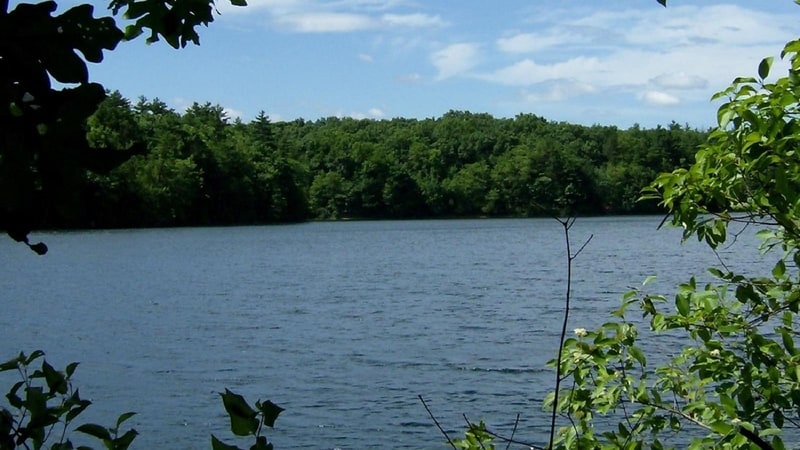
Image Source: National Park Service
- Location: Walden Pond State Reservation
- Trail Length: Approximately 2 miles
- Trail Type: Loop trail
- Trail Difficulty: Easy
- Estimated Time: 1 hour
The Walden Pond is a famous kettle pond located in the Walden Pond State Reservation. It’s best known for being a refuge to Henry David Thoreau. This trail takes you on a casual stroll around the pond and leads you past Henry David Thoreau’s historic cabin site. The Walden Pond Path also features several beaches and some great fishing spots.
The Walden Pond State Reservation totals 335 acres of gentle hills and protected open space. It’s part of the Massachusetts Forests and Parks system.
The Walden Pond Path is a new experience every season. In the summer, it’s a popular swimming destination. Many people hike the trails for their scenic views in the spring and fall. In the winter, the pond freezes over and becomes a winter wonderland. There are interpretive programs and guided walks offered year-round at Walden Pond.
Moderate Hikes near Boston
Great Blue Hill (via Blue Hills Skyline Trail)
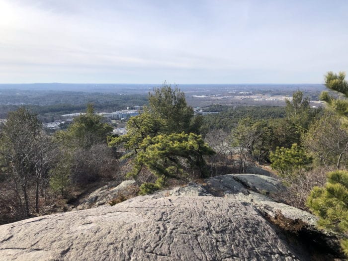
Image Source: Dig Boston
- Location: Blue Hills Reservation
- Trail Length: Approximately 3 miles
- Trail Type: Loop trail
- Trail Difficulty: Moderate
- Estimated Time: 1 ½ hour
The Great Blue Hill is rich in history. European settlers named it its blue hue given off by its exposed granite surface. Previously, the hill was named Massachuesett by Native Americans. This name later inspired the name for the state we know today.
Although it’s only 640 feet above sea level, the Great Blue Hill is the highest point in elevation in the immediate Boston area. From the top of the hill at Eliot Tower, you’ll have panoramic views of the Boston Metro Area. It’s no wonder this is such a popular hike!
The Blue Hills Reservation is located just minutes from the busy downtown of Boston. It protects the natural habitats that surround this incredible trail. Along the Blue Hills Skyline Trail, you’ll walk past ponds, marshes, and swamps, through high and lowland forests and meadows. You can park for free at Houghton’s Pond parking lot to access this scenic trail.
Mount Wachusett Summit
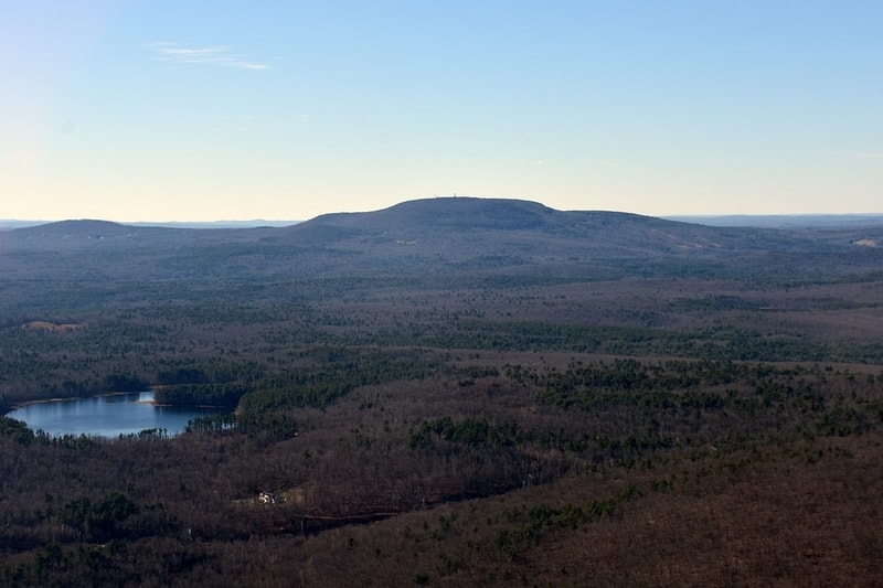
Image Source: Wikipedia
- Location: Wachusett Mountain State Reservation
- Trail Length: Approximately 5 miles
- Trail Type: Loop trail
- Trail Difficulty: Moderate
- Estimated Time: 2 ½ hours
You’ll surely enjoy this loop trail that takes you to the peak of Mount Wachusett via Old Indian, Stage Coach, and Bicentennial Trails.
Mount Wachusett stands at 2,006 feet, making it the tallest mountain near Boston. During the winter, it’s very popular with skiers. In all other seasons, though, the hikers take on the mountain. As a result, you can see as far as Mount Monadnock in New Hampshire on clear days. You can also see the Berkshire Mountains in western Massachusetts and the Boston skyline.
The mountain is located in the 3,000-acre Wachusett Mountain State Reservation. The reservation preserves the forests, meadows, streams, and fields you can explore through 17 miles of hiking trails. The largest area of old-growth forest in eastern Massachusetts is also located inside the reservation. Some trees are more than 350 years old!
Park in the parking lot near the visitor center to access this trail. The Wachusett Mountain State Reservation near Princeton, Massachusetts.
Outer Reservoir Skyline Trail Loop
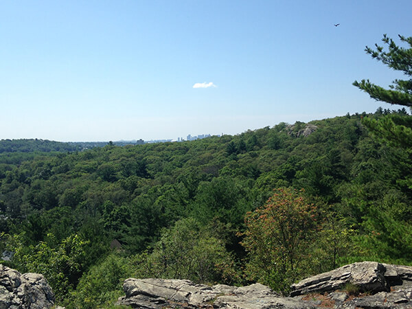
Image Source: Boston Magazine
- Location: Middlesex Fells Reservation
- Trail Length: Approximately 8 miles
- Trail Type: Loop trail
- Trail Difficulty: Moderate
- Estimated Time: 4 hours
You can access this beautiful trail in the Middlesex Fells Reservation near Medford, Massachusetts. The reservation boasts 2,575 acres of scenic rocky and hilly terrain. Because of this, the Middlesex Fells attracts both experienced hikers and those looking for a stroll in the woods.
The Outer Reservoir Loop of the Skyline Trail takes you across a terrain of boulders, forests, and ponds. While on this trail full of climbs and descents, you might even forget that you’re still nestled within the Boston suburbs.
A highlight of the Outer Reservoir Skyline Trail is Wright’s Tower at the southeast corner. You can see the Boston skyline and the miles of traffic below from the tower. Yet, despite being so close to the chaos of the city, there’s a distinct peacefulness in the Middlesex Fells.
Difficult or Multi-Day Hikes near Boston
Mount Hitchcock and Summit House Loop Trail
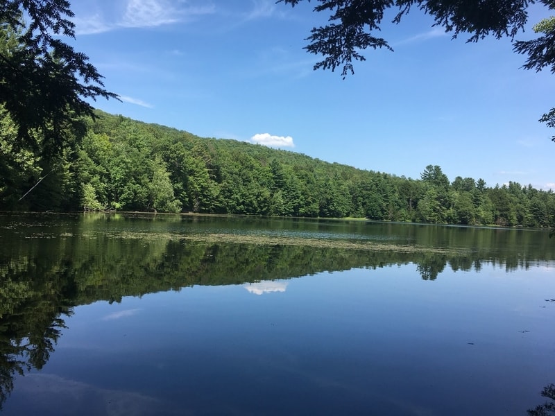
Image Source: AllTrails
- Location: Mount Holyoke State Park
- Trail Length: Approximately 13.5 miles
- Trail Type: Loop trail
- Trail Difficulty: Difficult
- Estimated Time: 7 hours
Enjoy the lovely views along the 13.5-miles of the trail via the Metacomet & Monadnock and Dry Brook Trail near Amherst, Massachusetts. This trail is open year-round and is a trendy area for camping, hiking, and trail running. There’s a good chance you’ll see others enjoying this beautiful trail, too!
Mount Hitchcock is located within the Mount Holyoke Range State Park. It’s a place for public recreation, and it encompasses the eastern half of the Holyoke Mountain Range in the Pioneer Valley region of Massachusetts.
The route to the peak of Mount Hitchcock and Summit House has lots of ups and downs. While this trail is moderately challenging, with a total elevation gain of 2,493 feet, the excellent views are worth it!
Mount Monadnock Summit (via White Dot and White Cross Trails)
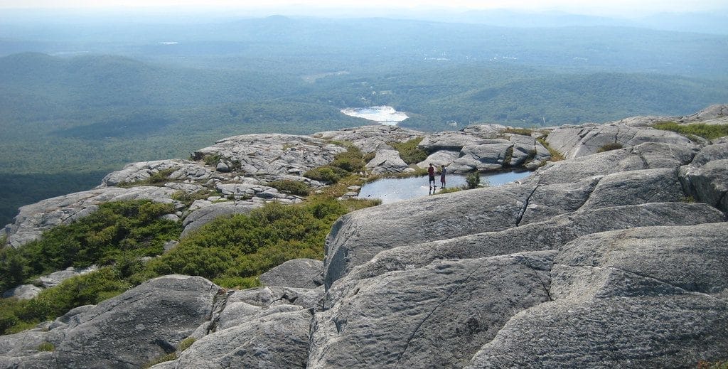
Image Source: Hiking and Fishing
- Location: Monadnock State Park
- Trail Length: Approximately 4 miles
- Trail Type: Loop trail
- Trail Difficulty: Difficult
- Estimated Time: 3 hours
This route to the peak of Mount Monadnock is a challenging hike along the side of the mountain. But the views from the summit are so rewarding! Mount Monadnock is one of the most climbed mountains in the Western Hemisphere. It’s located in the Monadnock State Park, just north of very populated cities in Vermont and Massachusetts. Other popular trails in the area include the White Cross Trail, Birchtoft Trail, Cascade Link Trail, and Pumpelly Trails.
The word “Monadnock” comes from the Native Abnaki language. it loosely translates to “mountain that stands alone.” Boston and the White Mountains are visible from the summit on a clear day.
The White Dot and White Cross Trails that take you to the peak are very steep and require some rock-hopping. But, even with the challenge, you can finish this stunning hike in a half day.
Metacomet-Monadnock Trail (Section 7)
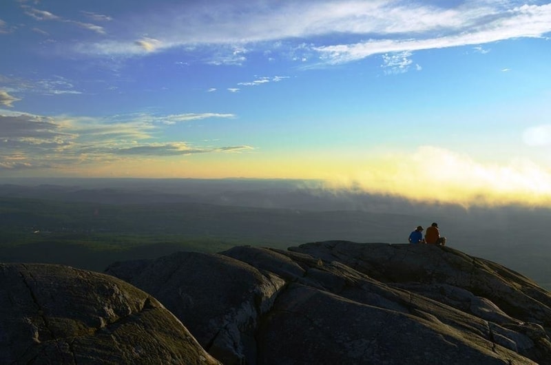
Image Source: Trail Finder
- Location: Mount Holyoke Range State Park
- Trail Length: Approximately 10 miles
- Trail Type: Out-and-back trail
- Trail Difficulty: Difficult
- Estimated Time: 6 hours
The Metacomet-Monadnock Trail (also called the M&M Trail) totals 114 miles. It traverses the Metacomet Ridge of the Pioneer Valley region of Massachusetts and the central uplands of Massachusetts and southern New Hampshire. Section 7 of the M&M trail is about 10 miles. Therefore, it can be completed as a challenging day hike.
Section 7 traverses the Seven Sisters, a series of basalt ridgelines between Mount Holyoke and Mount Hitchcock. The Seven Sisters are part of the Holyoke Range, and they’re located within the Pioneer Valley region of Massachusetts. Section 7 is also a part of the New England National Scenic Trail.
The tallest “sister” has an elevation of 1,005 ft. The terrain along the M&M trail is a rugged trek along the ridgeline. In total, you’ll experience an overall elevation change of 3,700 feet.
Before You Go: Recommended Gear for Hiking Near Boston
It would be best to consider the weather and the time of year when deciding what hiking gear to bring on your hike in Boston.
- Water: Plan to bring at least a liter of water. In the warmer months, you should plan to drink between ½-1 liter of water per hour of hiking.
- Snacks: Bring plenty of nutritious snacks on your hike. It’s essential to keep your body fueled if your hike takes longer than expected!
- Good hiking shoes: Make sure that your hiking footwear is durable and appropriate for terrain and time of year.
- Extra layers: Especially in the spring and fall, the temperature and weather can change very quickly. Make sure you have warmer layer options for sudden weather changes to be prepared. See best hiking pants for men and women.
- Rain gear: It can rain a lot in New England, depending on the season! Always be prepared for a surprise rain shower with durable rain layers.
- First aid kit: You never know what could happen on the trail! Be prepared for injury or illness by packing a first aid kit.
- Map and compass: Even if you’re familiar with the hiking trail, it’s always good to bring a paper trail map and compass.
Hiking Near Boston, Massachusetts FAQs
What’s the weather like around Boston?
The Boston climate can be both humid subtropical and humid continental. In the winter, it’s usually windy, snowy, and cold. In the summer, it’s typically dry, warm, and sometimes rainy. Spring and fall tend to be mild, with occasional rain showers. Throughout the seasons, the temperature varies from 23°F to 82°F. It’s rarely below 9°F or above 91°F.
When is the best time to visit Boston?
The best time to visit Boston is from June to October. The mild fall weather is perfect for scenic hikes in the mountains. The summer months can bring in a lot of tourists, but the outdoor recreation, sidewalk cafes, and outdoor concerts make it worth a visit!
Where can I camp near Boston?
If you’re looking to camp on your trip to Boston, check out these great options.
- Myles Standish State Forest in South Carver, MA.
- Dune’s Edge Campground in Provincetown, MA.
- Blue Hills Reservation in Milton, MA.
- Pinewood Lodge Campground in Plymouth, MA.
What’s the closest hiking to Boston?
There are so many miles of beautiful hiking trails within minutes of the city.
- Blue Hills Reservation is a green oasis within the urban city.
- Middlesex Fells Reservation is just north of Boston in the suburb of Stoneham.
- Breakheart Reservation is an extensive trail system near Boston.
- Mount Misery is the largest conservation area in Lincoln, Massachusetts.
Does Boston have woods?
Although Boston has a dense downtown full of old streets, it boasts many wooded open spaces and recreation areas.
Are there mountains near Boston?
Yes, there are a surprising number of mountains near Boston. For example, Mount Wachusett is the tallest mountain near Boston, standing 2,006 feet. And although Massachusetts is only 190 miles long from east to west, the New England Appalachians dominate most of the state.
Get Started Planning Your Boston Hiking Trip
Are you surprised at the number of beautiful hiking trails Boston offers? Now that you know that there’s so much more than what meets the eye, it’s time to plan your hiking trip in Boston.


Leave a Reply