What comes to mind when you think of Nashville, Tennessee? Maybe you think of live music, fried chicken, or cowboy boots. But, something you might not know about this charming city is that it’s also an escape for all who love the outdoors. Nashville may be the music city, but it’s also just a step away from lush forests, striking rock formations, and some pretty stunning waterfalls. Nashville is the center of what’s known as Tennessee’s Land Of Waterfalls. It’s possible to explore many waterfalls in one perfect day trip!
Suppose you’re ready to explore all of Nashville’s wild, breathtaking beauty; keep reading this guide to see our list of the best hikes near Nashville! No matter the duration of your stay. These outdoor adventures are the perfect way to spend a hiking getaway.
Table of Contents
Easy Hikes Near Nashville
Narrows of the Harpeth Trail
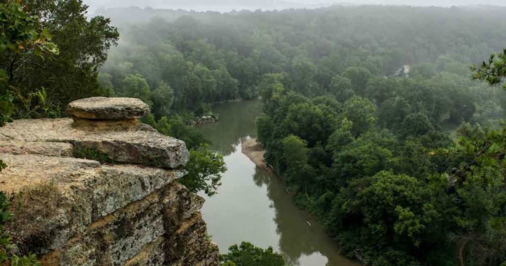
Image Source: TN State Parks
- Location: Narrows of the Harpeth State Park
- Trail Length: 1.1 miles
- Trail Type: Out-and-back trail
- Trail Difficulty: Easy
- Estimated Time: ½ hour
Narrows of the Harpeth is an easy, short trail suitable for people of all ages and skill levels. The trail boasts a gorgeous overlook of Harpeth Valley at the top of the limestone bluff.
As you walk through the forest, you’ll see why hikers find this trail incredible. The landscape indeed looks otherworldly! And as you approach the end of this short out-and-back hike, you’ll come across one of Tennessee’s most fascinating natural landmarks – a waterfall that runs out of a hole in the rocks!
The Narrows of the Harpeth Trail is very accessible at just a 30-minute drive from Nashville’s city center! This Nashville trail will help you rediscover the beauty of Tennessee’s nature.
Radnor Lake Trail
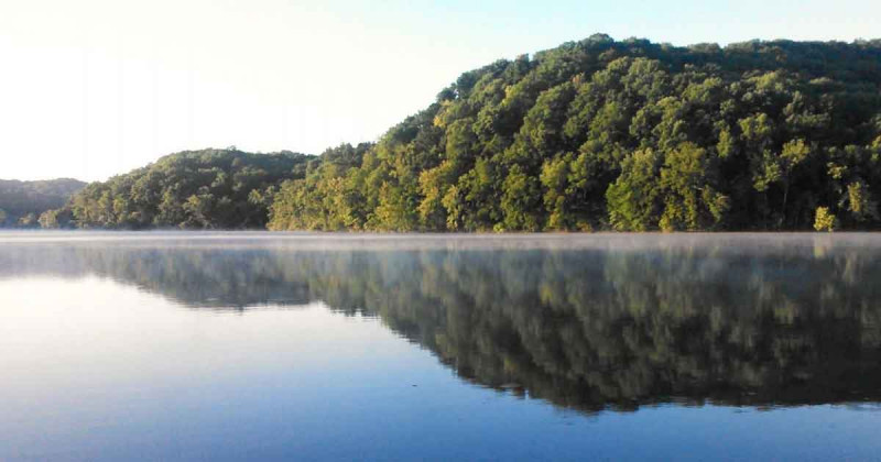
Image Source: Tennessee State Parks
- Location: Radnor Lake State Park
- Trail Length: 2.7 miles
- Trail Type: Loop Trail
- Trail Difficulty: Easy
- Estimated Time: 1 hour
Radnor Lake Loop Trail is one of the most popular hikes around Nashville. The path takes you around the perimeter of Radnor Lake, offering you lovely waterfront views. The trail is easy and flat, making it perfect for hikers of all levels. However, dogs aren’t allowed on this trail!
The Radnor Lake Trail is a catch-all of everything you could want in a quick nature getaway from the city. It’s conveniently located just a half-hour drive outside Nashville in the Radnor Lake State Park. Boasting plentiful wildlife and stunning lake views, Radnor Lake is a fantastic place for a day hike! Come early in the morning to snag a parking spot and hit the trail before the crowds for a peaceful, quiet walk around the lake.
Moderate Hikes Near Nashville
Montgomery Bell Trail
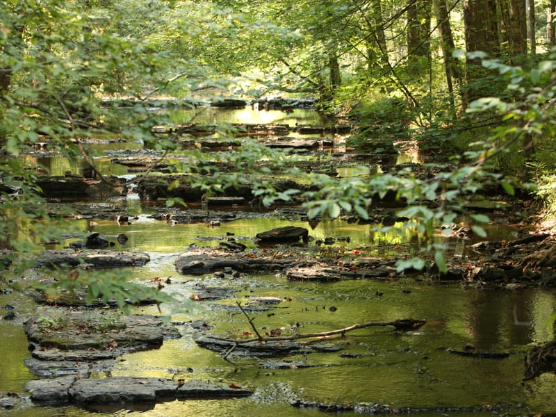
Image Source: State Parks
- Location: Montgomery Bell State Park
- Trail Length: 10.4 miles
- Trail Type: Loop trail
- Trail Difficulty: Moderate
- Estimated Time: 4-5 hours
Montgomery Bell State Park is situated in the beautiful forests near Burns, Tennessee. The Montgomery Bell Trail is considered a moderately challenging trail, and it’s a popular location for backpacking, camping, and fishing. The trail is open year-round and is something to revel at any time! Dogs are welcome, but they must be kept on leash.
The Montgomery Bell Trail truly has a little bit of something for everyone. Whether you’re interested in history, dazzling landscapes, or a variety of terrain, this trail won’t disappoint!
Along the trail, you’ll stroll by a historic log cabin and mining area and the site of the first Cumberland Presbyterian Church, founded in 1810. The Montgomery Bell Trail also features quite a few small waterfalls and streams, with several stream crossings for an added challenge!
The trail travels through varied terrain and often follows a stream through the hardwood forest. Without bridges, you may have to get your feet wet at a few stream crossings! It also passes by two lakes which are popular fishing spots.
The Montgomery Bell Trail is mostly well marked, but some intersections can be confusing. Just be sure to pay attention and follow the white blazes!
Mossy Ridge Trail Loop
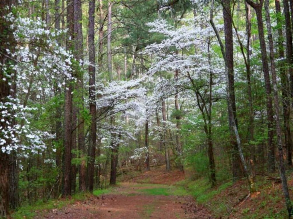
Image Source: Roots Rated
- Location: Percy Warner Park
- Trail Length: 5.3 miles
- Trail Type: Loop trail
- Trail Difficulty: Moderate
- Estimated Time: 2 ½ – 3 hours
The Mossy Ridge Trail loop is a moderate hike located within Percy Warner Park just outside of Nashville. It’s a widely popular trail which means you’ll likely see heavy traffic, especially in the peak season! Also, feel free to bring along your canine friends- just make sure they’re leashed.
The Warner Parks are some of the city’s most beloved green spaces, and on top of that, the Mossy Ridge Trail is a real crowd-pleaser! Along this trail, you’ll have a hilly and moderately tricky trek through the hills of Nashville. You’ll pass through some stunning, one-of-a-kind mossy spaces of the forest. In total, you’ll gain 882 feet in elevation.
With various steep and gradual inclines, it’s hard to go wrong with the Mossy Ridge Trail. However, be advised that sections of the trail are rocky. Make sure you’re wearing adequate footwear!
Difficult Hikes Near Nashville
Fiery Gizzard Trail to Raven’s Point
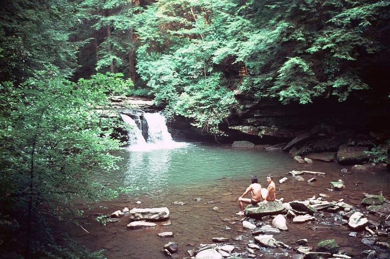
Image Source: Wikipedia
- Location: South Cumberland State Park
- Trail Length: 11.4 miles
- Trail Type: Loop trail
- Trail Difficulty: Difficult
- Estimated Time: 5-6 hours
The Fiery Gizzard Trail is located in Grundy Forest State Natural Area at South Cumberland State Park. You won’t be disappointed by this wooded trail full of stunning views of rock formations, cascading waterfalls, rocky gorges, and panoramic views. This trail tops many lists of beautiful hikes in Tennessee, and with the fantastic scenery comes the challenges of a strenuous hike. Don’t take this trail lightly- you’ll need some patience and stamina to traverse the rocky terrain and stream crossings. In all, you’ll experience an elevation gain of 1,459 feet. This is challenging, so make sure to give yourself plenty of time.
Along this challenging trail, you’ll pass Blue Hole Falls, Black Canyon and Falls, Chimney Rocks, Sycamore Falls, the Fruit Bowl, Foster Falls, Raven Point Vista, and Flat Rock Overlook Werner Point Overlook, Yellow Pine Cascade, Dog Hole Mine, and Hanes Hole Falls. Now that’s a lot of beauty you just can’t pass up!
Many users suggest making the trail counter-clockwise. This means that you’ll get through the rock ridge of Fiery Gizzard and boulder fields while you’re still fresh. You’ll still have a very steep climb out to the Dog Hole trail, but it is only a short distance to Raven point. The return trip on the Dog Hole trail is very moderate, with a reasonably easy descent back down to the Fiery Gizzard Trail. The trail is moderate back to the parking area at the trailhead.
Virgin Falls Trail
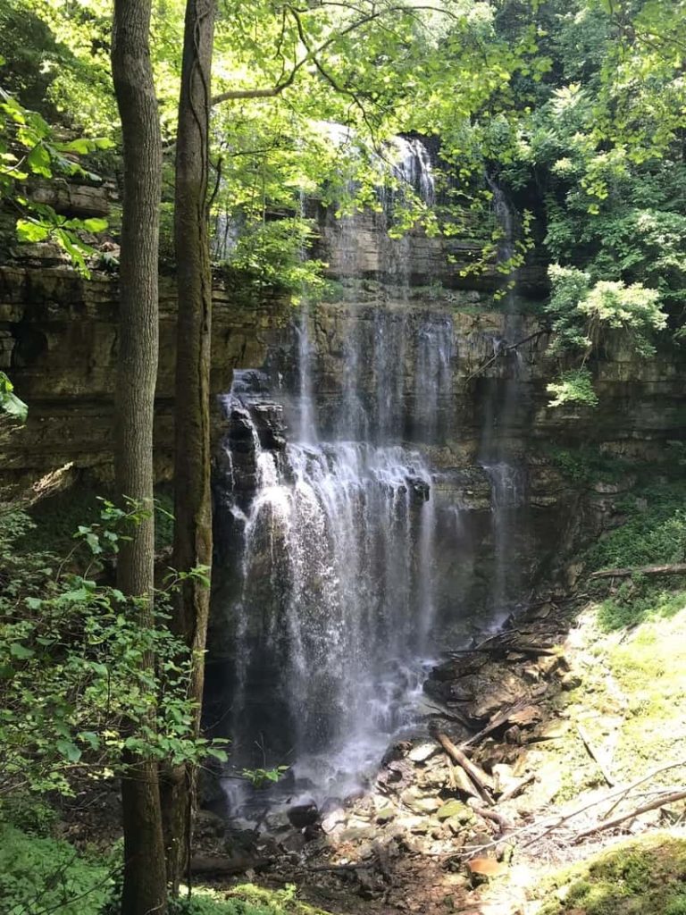
Image Source: AllTrails
- Location: Virgin Falls State Natural Area
- Trail Length: 8.7 miles
- Trail Type: Out-and-back trail
- Trail Difficulty: Difficult
- Estimated Time: 4-5 hours
Located halfway between Nashville and Knoxville, the Virgin Falls Natural Area is a striking natural landscape that will take your breath away.
The area is named after Virgin Falls; a waterfall formed out of a cave cascading over a 110-foot-high cliff. Other notable caves in this area include Big Laurel Falls, Sheep Cave Falls, and Big Branch Falls.
The Virgin Falls Trail is a long and strenuous trail that’s well worth all of its challenges. To complete this as a day hike, start very early. And if you want to turn this into a multi-day backpacking trip, there is camping at Overlook Junction, Martha’s Pretty Point, Virgin Falls, and Caney Fork. Camping is by reservation only.
You don’t have to go all the way to the falls for spectacular views. There are some great points of interest along the way, including Big Branch Falls, Overlook Junction, Martha’s Pretty Point, multiple caves, and a fun cable crossing.
Because the Virgin Falls Trail requires a fair amount of rock scrambling and steep ascents and descents, this trail is definitely not for a beginner hiker! But not to worry. Hikers who complete the course say the views are well worth the effort. So maybe you’ll just have to decide for yourself!
Waterfalls Hikes You Wouldn’t Want to Miss
Busby and Machine Falls Loop Trail
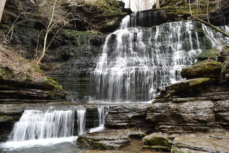
Image Source: Waterfall Record
- Location: Short Springs State Natural Area
- Trail Length: 2.4 miles
- Trail Type: Loop trail
- Trail Difficulty: Moderate
- Estimated Time: 1 – 1 ½ hours
The Machine Falls Loop is located within the Short Springs Natural Area near Tullahoma, Tennessee. It’s considered by many hikers to be a moderately challenging trail, but the stunning waterfall is well worth it. While it can be a popular trail for birding, fishing, and hiking, there’s still some room to enjoy solitude during the quieter times of the day. The trail is open year-round, and it’s a beautiful day hike to a stunning, secluded waterfall. In total, this trail features 732 feet in elevation gain.
The Machine Falls Loop Trail is well-marked with white blazes. The most challenging aspect of the trail is the short, steep descent into a gorge to access the beautiful waterfalls. But if you’re up for even more of a challenge, you can extend part of the loop by continuing up to Adams Falls Trail.
Burgess Falls Trail
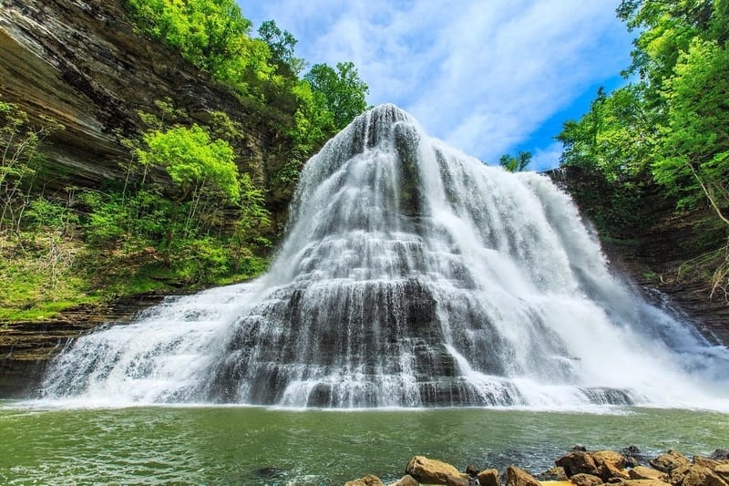
Image Source: Burgess Falls
- Location: Burgess Falls State Park
- Trail Length: 1.6 miles
- Trail Type: Out-and-back
- Trail Difficulty: Moderate
- Estimated Time: 1 hour
Another short and sweet favorite of the waterfall hikes is the Burgess Falls Trail, which is 1 ½ hours from Nashville. Burgess Falls is one of Tennessee’s most spectacular waterfalls and simply can’t be missed. This 135-foot waterfall wraps around the corner of a cliff, and it will truly take your breath away!
At the trailhead for this hike, the trail gently slopes downward as the river drops away. Along the way, you’ll pass by some small rocky outcroppings and cross bridges over small streams. There’s one short and steep section of stairs- but the challenge will be well worth the reward!
The first waterfall overlook is just a few minutes’ walk from the trailhead. As you continue, you will come to the middle falls overlook. And finally, you come to the excellent views of the main overlook. While Burgess Falls may not be the tallest waterfall in the state, it sure is one of the most impressive! Unfortunately, the trail from the overlook to the base of the falls is closed due to flood damage and instability.
To return to the trailhead, you can take the flat service road back to the parking lot faster than backtracking. However, it’s more scenic to return along the same route as you came.
Cummins Falls Trail
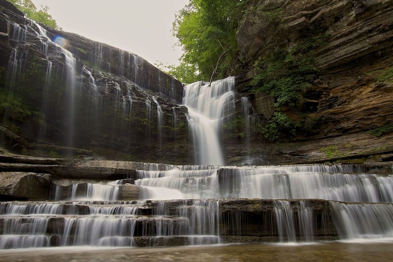
Image Source: Roots Rated
- Location: Cummins Falls State Park
- Trail Length: 3 miles
- Trail Type: Out-and-back trail
- Trail Difficulty: Moderate
- Estimated Time: 1 ½ – 2 hours
Cummins Falls Trail is located in Cummins Falls State Park. It’s a peaceful and rugged 306-acre day-use park just nine miles north of Cookeville on the Blackburn Fork State Scenic River. It’s also located in the Cordell Hull Watershed, a well-known scenic spot and swimming hole for local residents for more than 100 years. Cummins Falls is 75 feet high, and it’s Tennessee’s eighth largest waterfall in terms of volume of water.
Your Cummins Falls adventure begins at the overlook. Here you’ll climb down to a small passage that gets you a perfect look at the beautiful views of the falls. If you turn right away from the falls, you will follow the bluff’s edge downstream through a lush forest. However, if you want to visit the top of the falls first, the upstream trail leads off from the left of the overlook area and can also be used to return to the parking lot. Once you reach the stream bed, you will see many footpaths, and you will have to pick your path upstream.
Take caution on this trail! The rocks are slippery, and the stream is wide. It’s not uncommon for hikers to slip and fall in. So, stash the things you need to stay dry and take your time. On a quiet day, the falls feel rustic and remote. But in the peak summer season, it’s often hopping with swimmers.
What to Bring Hiking Near Nashville, Tennessee
It’s important to come well prepared today to hike around Nashville, Tennessee! But what are the essentials that should always make your packing list?
- Breathable hiking clothes: You’ll want to stay cool in a sweat-wicking top and breathable pants for warmer hikes. For the cooler months, you should dress in warm layers.
- Water bottles: Having water available at all times is a huge must! Hydration is essential for having a good time while hiking.
- Nutrition: Don’t forget your lunch and trail snacks! You’ll want to keep your body fueled all day long.
- Sunscreen and bug spray: Sweatproof sunscreen and DEET bug spray can help you avoid sunburn and bug bites- two things that can really get you down on a hike!
- A brimmed hat or cap: The sun is unforgiving on open, exposed hikes. Always pack a brimmed hat or cap for day hikes in the sunshine!
- First aid kit: We don’t want to think about it, but bad things can happen on the trail. It’s always best to play it safe and come prepared for anything.
- Trail map: Even if you’re familiar with the hiking trail, it’s always good to bring a paper trail map and compass.
- Durable day pack: A durable day pack is needed to keep all of your essential gear safe. It would be best if you looked for a daypack that will be comfortable and breathable for long hikes.
FAQs About Hiking Near Nashville, Tennessee
What’s the best time of year to visit Nashville hiking trails?
Nashville is great to visit in the spring, particularly between March and May. It’s also spectacular in the fall months of October and November, with beautiful colors. Also, the weather is pleasant, and there are not the crowds that you’ll find during the summer.
Where should I stay while hiking near Nashville, TN?
Camping options:
Lodging options:
- Budget hotel: Sleep In Nashville Airport
- Mid-range hotel: Homewood Suites
- Luxury hotel: Renaissance Nashville Hotel
How far are most hiking trails from Nashville?
Most hiking trails near Nashville, Tennessee, are within 2 hours’ driving distance. Many are within an hour.
What are the closest mountains to Nashville?
Great Smoky Mountains National Park near Nashville, TN.
What is the longest trail in Nashville?
According to AllTrails.com, the longest trail in Nashville is the Cumberland River Greenway.
If you’re ready to visit a place where you can take a leisurely stroll on miles of trails in the morning, go for a trial run in the afternoon, and hit the music city scene by the evening, Nashville, Tennessee, awaits you. And the variety of adventures and opportunities to explore can all be found within two hours of the city!


Leave a Reply