The Great Smoky Mountains are 800 square miles of beautiful mountainous forests on the border of North Carolina and Tennessee in the southeastern United States. The Smokies got their name for the lingering morning fog on the mountain peaks that resembles smoke.
Home to nearly 20,000 species of plants, fungi, and wildlife, the Smokies are ancient mountains are known for their diverse flora and fauna. The park is also a protected UNESCO World Heritage site, and it’s considered one of the morse biodiverse ecosystems in the world.
The Great Smoky National Park is divided by the Tennessee-North Carolina border. There are visitor centers in each state, Sugarlands in Tennessee, and Oconaluftee in North Carolina.
There’s something for everyone to enjoy in this national park. Whether you’re looking for the best day hikes, multi-night backcountry camping adventures, waterfalls, or scenic drives, you will not be disappointed in the Smokies. it’s no wonder why the Great Smoky Mountains National Park is the most visited national park in America!
Table of Contents
Popular Hikes in the Smoky Mountains
Alum Cave Trail to Mount LeConte
Location: Newfound Gap Road
Trail Length: 10.9 miles round-trip
Trail Type: Out & Back
Trail Difficulty: Difficult
Estimated Time: Around 7 hours
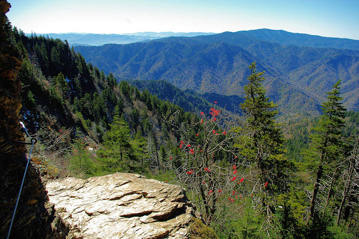
The Alum Cave Trail is a challenging but well-maintained trail that features a cave and incredible panoramic views.
After 1.3 miles from leaving the trailhead at Newfound Gap Road, you arrive at Arch Rock. This is a unique rock formation and distinguishing landmark that you won’t want to miss. After about another mile of climbing, you’ll reach a great lookout, Inspiration Point. Shortly after is Alum Cave Bluff. This is a great photo op with amazing vista views and unique cave formations with orange clay.
After Alum Cave, the LeConte Lodge is located about 5 miles from the trailhead. It’s the only formal lodging in Great Smoky Mountains National Park. If you choose to stay overnight, you have options to stay in a primitive cabin or the lodge. Keep in mind that you’ll have to book reservations in advance as this stay is very popular.
Beyond the lodge, you’ll see Bull Head Trail which leads to Boulevard Trail. This is the trail you’ll take the remaining distance to the summit of Mt LeConte. At 6593 feet, this is the third highest peak in the Smokies.
If you want some gorgeous panoramic views without the summit, hike .2 miles beyond the LeConte Lodge to reach Cliff Top. This spot gives you 360 views of the Smokies. From this point, you can see Newfound Gap, Chimney Tops, and Gatlinburg on a clear day.
Cades Cove Nature Trail
Location: Cades Cove Loop Road
Trail Length: 2 miles round-trip
Trail Type: Loop
Trail Difficulty: Easy
Estimated Time: 1 hour
Cades Cove is one of the best hiking spots in the Great Smoky Mountains National Park. It features beautiful meadows surrounded by tall mountains. This easy hiking trail is a perfect outing for an afternoon with the family. It’s also a great way for new hikers to get some experience!
The trailhead for this nature trail is about 7 miles into the Cades Cove Loop Road and 1 mile past the visitor center. While you may choose to take a scenic drive for great views around this road, hiking is truly the best way to explore this area. Along this easy day hike, you’ll come across the remains of an old chestnut grove. There’s a variety of large, stunning trees including oaks, dogwoods, and pine trees.
In the spring and summer months, you’ll be blown away by the plentiful wildflower blooms. Many hikers also report seeing bears and other wildlife in this area. At just 2 miles, it’s easy to fit in this can’t-miss day hike!
Chimney Tops Trail
Location: Newfound Gap Road
Trail Length: 4 miles round-trip
Trail Type: Out & Back
Trail Difficulty: Difficult
Estimated Time: 2-3 hours
The Chimney Tops Trail is one of the most popular day hiking trails in the Great Smoky Mountains National Park. It may be a challenge, but it’s so worth it!
To hike this out and back trail, you begin at the Chimney Tops Trail parking area. From there, you begin the steep climb with 1,400 feet of elevation gain over two miles. The climb may not be long, but make sure to give yourself time to tackle this steep grade!
Along the way, you will meander through dense forest and cross the cascading West Prong Little Pigeon River on a footbridge three times. As you get close to the summit, the final 75 feet of ascent requires a bit of rock scrambling. These rocks can be slippery when wet or icy, so make sure to use caution here.
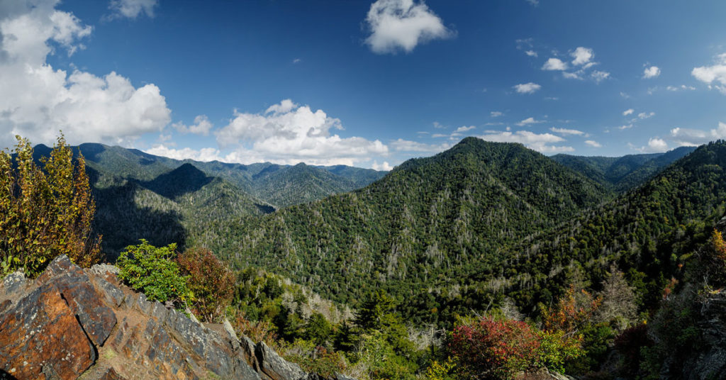
Chimney Tops is a bare rock summit. It’s a unique geological formation and a rare rock summit in the Smokies with steep cliffs on every side. Get ready for some pretty incredible panoramic views of mountain vistas that stretch for miles!
Clingmans Dome Summit

Location: Clingman’s Dome Road
Trail Length: 1-mile round-trip
Trail Type: paved loop
Trail Difficulty: Moderate
Estimated Time: 40 minutes
This popular hiking trail is fully paved. Although it is only a half-mile to the summit of Clingmans Dome, it’s a moderately difficult trail due to its steep grade and high altitude. While this trail may be strenuous, there are plenty of benches along the way to stop and rest.
You begin at the trailhead which is located at the parking area of the visitor’s center. At one point on your climb to the summit, the trail will intersect with Appalachian Trail. When you reach the top of the Clingmans dome, you’ll get panoramic views of the Great Smokies. There’s also an observation tower at the peak the provides particularly spectacular views.
The “dome” of Clingmans Dome is the mountaintop. While it actually lies within both Tennessee and North Carolina, this summit is the highest point in Tennessee! And at 6,643 feet, it’s also the highest point in the Great Smoky Mountains National Park. Bring a picnic lunch to spend some time at the rocky top and enjoy stunning views!
Charlies Bunion via Appalachian Trail
Location: Newfound Gap Road
Trail Length: 8 miles round-trip
Trail Type: Out & Back
Trail Difficulty: Difficult
Estimated Time: 5-6 hours
If you’re looking for a long, challenging day hike, this trail is for you! With an elevation gain of 1,640 feet, this trail hits multiple peaks including Mount Ambler and Masa Knob before it finishes at Charlies Bunion.
From the trailhead at the parking lot, follow the signs and the white blazes of the Appalachian Trail toward Icewater Spring. This section of the Appalachian Trail is a green tunnel covered in an old-growth forest with a few lookout points with gorgeous views along the way. During the spring and summer months, you’ll also be rewarded with a variety of high-elevation wildflower blooms. This trail is a great representation of the North Carolina high country!
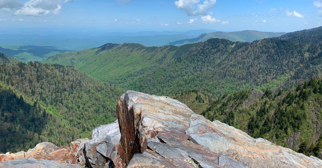
About 4 miles from the trailhead, you reach your destination: Charlies Bunion. It’s a rugged rocky outcropping boasting spectacular panoramic views of the surrounding mountains. From the top of Charlie’s Bunion, you can see Mount Kephart to the west, Mt LeConte to the northwest, and Mount Guyot to the east.
From Charlie’s Bunion, you can take a short side trail to visit the Jump Off. Many hikers say that the stunning views from this additional one-mile round-trip are absolutely worth it!
Hidden Gem Hikes in the Smoky Mountains
Andrews Bald Trail

Location: Clingmans Dome Road
Trail Length: 3.6 miles round-trip
Trail Type: Out & Back
Trail Difficulty: Moderate
Estimated Time: 2-3 hours
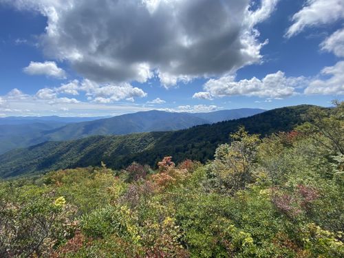
This moderately difficult hiking trail is a great day hike that provides great views on its way to one of the few balds within the Smoky Mountains. Balds are mountaintops that are covered by grasses, rhododendron, and mountain laurel.
This trail begins at the Clingmans Dome parking area. Look for a short descending trail that takes you to the Forney Ridge Trail. The first mile of this trail is steep and downhill. It can be quite rocky and difficult, so make sure to wear sturdy shoes!
Along the Andrews Bald Trail, you begin in Tennessee and eventually cross over into North Carolina. After the steep downhill, the trail then heads back uphill through a green tunnel forest to Andrews Bald, one of several balds in the Great Smoky Mountains National Park. The panoramic views from the top of Andrews Bald are pretty incredible! And at 5,920 feet, Andrews Bald is the highest grassy bald in the Great Smoky Mountains National Park.
Mt Cammerer via Low Gap Trail
Location: Cosby, Tennessee
Trail Length: 11.1 miles
Trail Type: Out & Back
Trail Difficulty: Difficult
Estimated Time: 8-9 hours
If you’re looking for a longer challenging trail with relatively low traffic, this trail is for you! Some hikers choose to conquer this 11-mile out-and-back as a day hike, but many people also choose to turn It into an overnight backpacking trip.
The trail to the Mount Cammerer summit begins at the Low Gap Trailhead in the Cosby Campground. From there, you will climb to reach the junction of the Appalachian Trail through a canopy of dense hardwood forest.
At this point, the trail levels out to provide you with spectacular views of Cosby Valley, Snake Den Ridge, and Inadu Knob. From here, you continue along the rocky spur trail to Mount Cammerer.
The summit of Mount Cammerer is at an elevation of 4,928 feet. The panoramic views from this peak are incredible any time of year, but the colors of autumn are particularly stunning. While you’re up there, make your way to the fire tower for views of the Pigeon River Gorge, Snowbird Mountain, Mount Sterling, and the Smoky Mountains. There’s not much that can compare to the stunning nature of this summit!
Mt. Sterling Summit via Mt. Sterling Gap
Location: Mt. Sterling Gap
Trail Length: 5.6 miles round-trip
Trail Type: Out & Back
Trail Difficulty: Difficult
Estimated Time: 3 hours
This trail is moderate in both length and difficulty which makes it perfect as a rewarding day hike.
The Mt. Sterling area is known as one of the more historic places in the Smokies. In this quiet, lesser-known area, the valleys around the base of this remote mountain were common hideouts for deserters during the civil war.
You begin at the trailhead alongside Mt. Sterling Road. It’s a fairly steady climb from the beginning. The ascent to Mt. Sterling Summit isn’t easy, as you climb 2,000 feet in just under 3 miles. But the steady climb up the trail is well-maintained.
Along the trail, you will hike through a beautiful old-growth forest. You will continue climbing switchbacks that offer spectacular views of the Little Cataloochee area. As you gain elevation, the greenery changes from hardwood forest to fir and spruce.
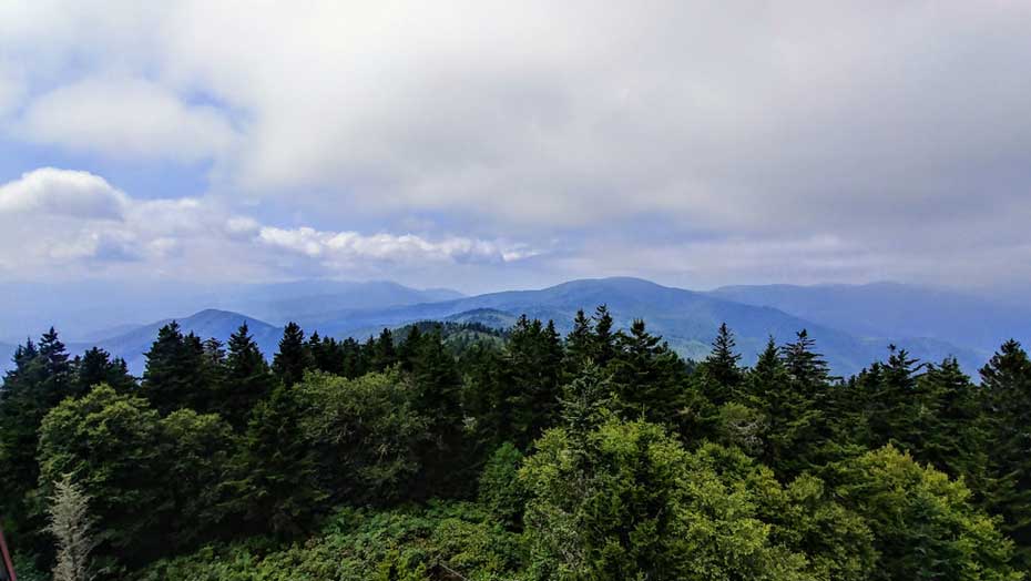
At about 2.6 miles, you will reach the Mt. Sterling Trail Junction. Turn right at this junction to continue another half-mile to reach the 5,842-foot summit of Mt. Sterling. When you reach the peak, you’ll see the 60-foot fire tower that was built by the Civilian Conservation Corps in 1935. This is the highest elevation fire tower in the eastern United States!
You will without a doubt love the stunning panoramic views from the fire tower. On a clear day, you can see vistas from landmarks Mt. Guyot, Mt. Cammerer, and Max Patch.
Hikes with Waterfalls in the Smoky Mountains
Abrams Falls
Location: Cades Cove
Trail Length: 5.2 miles round-trip
Trail Type: Out & Back
Trail Difficulty: Moderate
Estimated Time: 2-3 hours
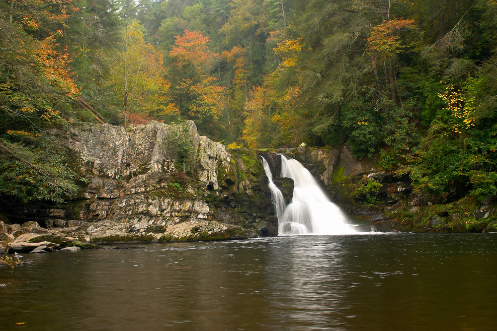
This moderately difficult trail features a can’t-miss waterfall in the beautiful Cades Cove area. Keep in mind that hikers get injured on wet slippery rocks around the falls, so use an abundance of caution. There are also strong currents in the pool at the base of the falls, so swimming in this pool is strongly discouraged.
This trail begins at the Abrams Falls trailhead. The trail from Cades Cove to Abram Falls weaves around mountain ridges while following the babbling Adams Creek. It takes you through a green tunnel of a stunning pine-oak forest. As you get closer to the falls, you will pass through more unique rhododendron and hemlock forests. It’s no wonder why this trail is called one of the most scenic forest hikes in the Smokies!
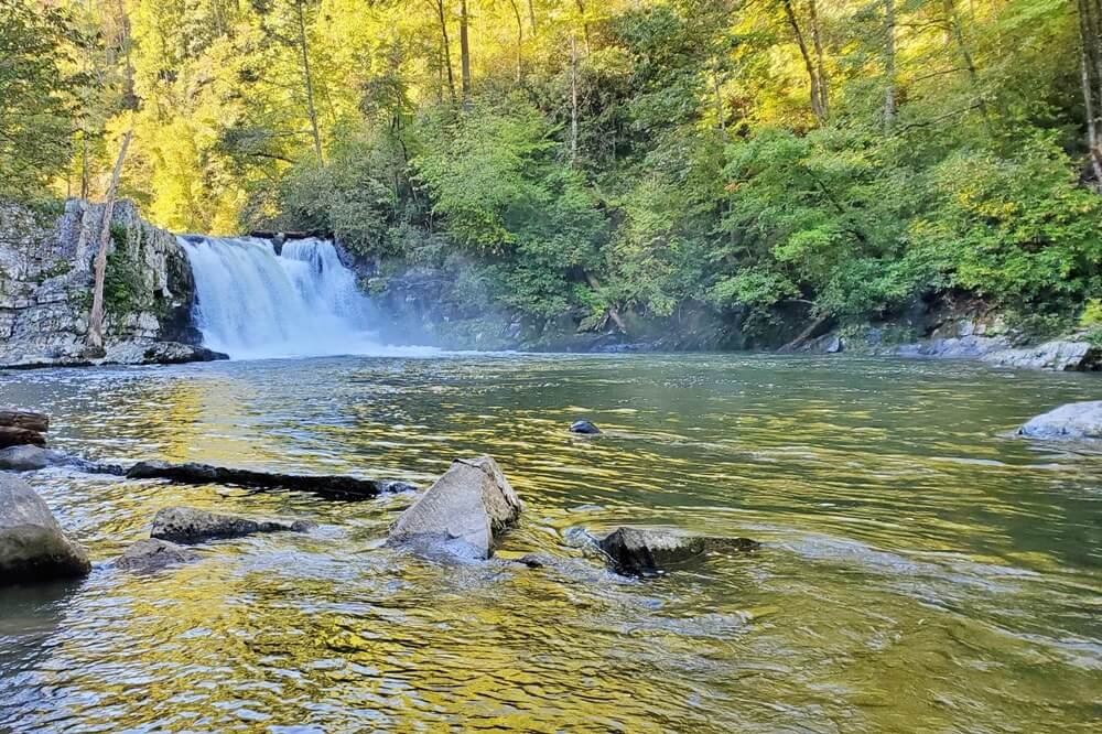
After about 2.5 miles of hiking through the forest, you will reach a short side trail leading to Abrams Falls. This is a beautiful cascading waterfall is a great place to stop and have a picnic lunch. While the falls are not super tall at just 20 feet high, the large volume of water makes them so impressive.
Grotto Falls Trail
Location: Roaring Fork Nature Trail
Trail Length: 2.6 miles round-trip
Trail Type: Out & Back
Trail Difficulty: Moderate
Estimated Time: 1-2 hours
This family-friendly moderate hike is well-shaded and perfect for a hot sunny day!
The trail begins at the marked trailhead in the parking lot for the Trillium Gap Trail. You’ll walk through a stunning old-growth forest with large hemlock trees. If you hike this in the spring, you’ll see a beautiful wildflower bloom.
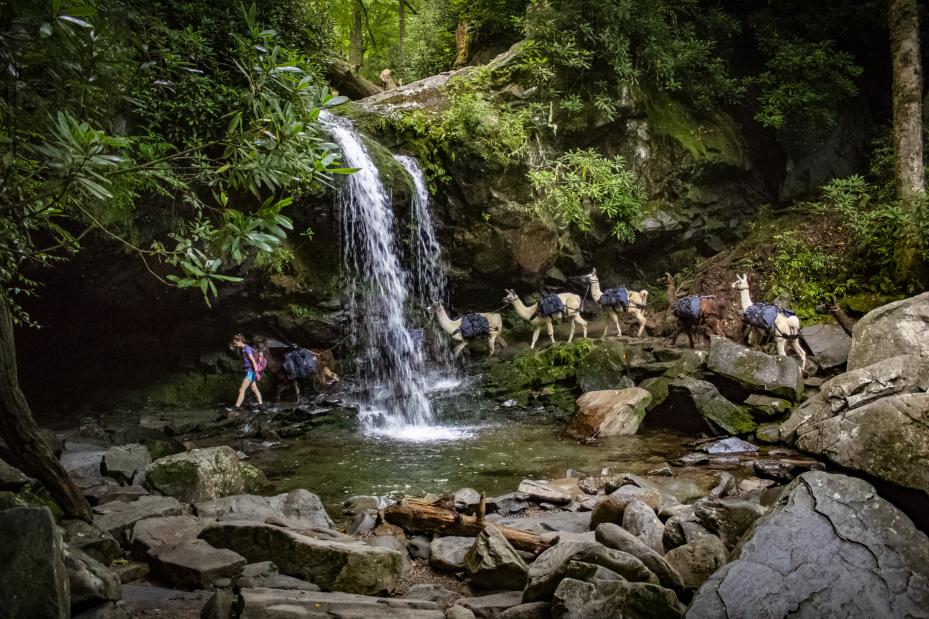
Along the trail, you’ll cross four streams before finally coming to a cascade where upstream Grotto Falls will come into view.
As you approach the falls, you’ll begin to feel the cool mist coming off of the water. Make sure to bring your camera to get shots walking along the small walking trail behind the falls! Grotto Falls is the only falls in the Great Smoky Mountains National Park that has a walking path behind it. You won’t want to miss this incredible waterfall hike!
Porters Creek Trail
Location: Pigeon Forge
Trail Length: 4 miles round-trip
Trail Type: Out & Back
Trail Difficulty: Moderate
Estimated Time: 1-2 hours
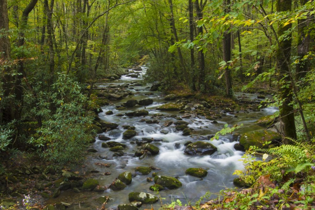
This moderate family-friendly hike is a great hike all year-round. But in the spring and summer. months, you’ll encounter some particularly scenic wildflowers.
To hike this trail, you begin at the marked trailhead and follow a gravel road for the first mile. As you hike, the trail follows alongside Ports Creek. From there, you will come across the remains of an old farmstead and cemetery.
Go left at the fork to continue on Porters Creek Trail to reach the falls. The gravel road then turns into a trail as you enter a green tunnel of old-growth forest. The trail comes to an end at the 60-foot Fern Branch Falls. With the shade of the trees and the cool mist coming off of the falls, this is the perfect resting spot on a hot summer day!
Rainbow Falls Trail
Location: Roaring Fork area near Gatlinburg, Tennessee
Trail Length: 5.4 miles round-trip
Trail Type: Out & Back
Trail Difficulty: Moderate
Estimated Time: 4-5 hours
This moderate hiking trail is a rewarding hike the entire way to the falls.
You begin at the Rainbow Falls parking area within the Great Smoky Mountains National Park. The trail is rated a moderately difficult trail due to the rocky terrain in sections and the 1,500 feet of elevation gain.
You’ll hike through a lush green forest as the trail runs alongside LeConte Creek. After one mile, reach an overlook that provides stunning views. As you continue along the trail, you’ll cross a few bridges before the first views of the falls.
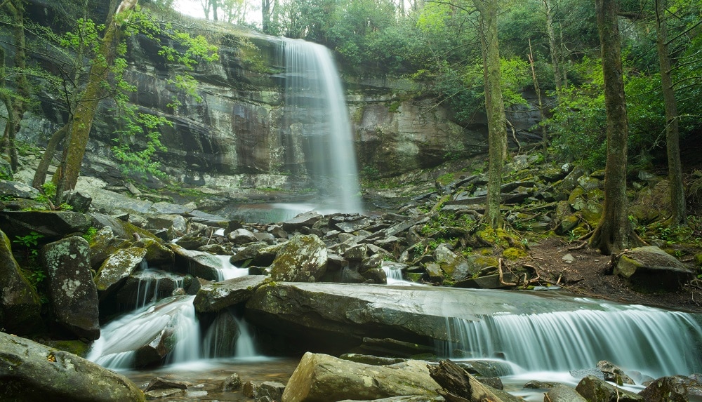
The trail eventually brings you to Rainbow Falls. This stunning waterfall is 80-feet tall. The falls get their name from the rainbows that can be seen in the mist on sunny afternoons. Use caution around the rocks of the falls as they are slippery and can be dangerous.
Dog-Friendly Hikes in the Smoky Mountains
Gatlinburg Trail
Location: Gatlinburg, Tennessee
Trail Length: 3.9 miles round-trip
Trail Type: Out & Back
Trail Difficulty: Easy
Estimated Time: 2 hours
This is an easy, well-graded gravel trail that is conveniently located. This family-friendly trail is one of only two trails in the Great Smoky Mountains National Park that is both dog-friendly and bike-friendly.
This trail links the busy Sugarlands Visitor Center with the bustling town of Gatlinburg. Begin the Gatlinburg Trail at the trailhead off of the visitor’s center. As you continue along the trail, you will follow the West Prong of the Little River through a stunning hardwood and rhododendrons forest.
Keep in mind that you will be sharing the trail with bicyclists. Remember to be courteous!
Oconaluftee River Trail
Location: Cherokee, North Carolina
Trail Length: 3 miles
Trail Type: Out & Back
Trail Difficulty: Easy
Estimated Time: 1-2 hours
This easy, family-friendly trail offers some history and is perfect for an afternoon day hike! This is one of two hiking trails that is both dog-friendly and bike-friendly within the Great Smoky Mountains National Park.
You will find the trailhead at the Oconaluftee Visitor’s Center just outside of Cherokee, North Carolina. The trail begins through the open-air Mountain Farm Museum, which is a collection of log buildings from around the park. This trail is aptly-named “Oconaluftee” comes from a Cherokee word that means “by the river”.
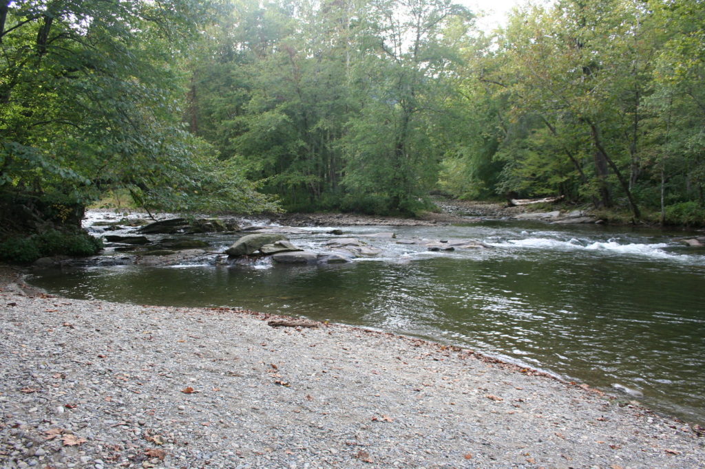
This trail is relatively flat with some small hills along the way. As you continue hiking through the green tunnel forest, you will walk alongside the Oconaluftee River. This old-growth forest is diverse with trees like hemlock, maple, and dogwood, among others.
This trail offers beautiful views all year round. In mid to late spring, you will find plentiful wildflowers blooms of more than 40 species. And if you hike during autumn, you will see the beautiful aster bloom. To complete this trail, you will turn around where the trail ends at the national park boundary in Cherokee and hike back to the trailhead.


Rename the Great Smoky Mountains to The Great Glistening Mountains…