Santa Fe is a popular destination for visitors seeking outdoor adventures in New Mexico. It’s a cute town with a fascinating and rich history. It also features a wide variety of unique dining and lodging options, art galleries, and shopping opportunities.
Taos, New Mexico, is just a short highway drive from Santa Fe. This quaint town is known for its ski mountain and the pueblos built by the Northern Tiwa tribe over a thousand years ago. The culture surrounding art in Taos is well-known, and it pulls in visitors for many of the same reasons as Santa Fe does.
Both Santa Fe and Taos are situated in the foothills of the Sangre de Cristo Mountains. This mountain range extends 300 miles into Colorado. Additionally, the Rio Grande flows in this section of northern New Mexico. For this reason, whitewater recreation it’s also a popular activity in Santa Fe. And last but certainly not least, Santa Fe and the surrounding area offer a variety of outdoor exploration and hiking opportunities for any adventurer. Keep reading to discover the can’t miss hikes in Santa Fe!
Table of Contents
- 1 Tsankawi Ruins Trail
- 2 Picacho Peak Trail
- 3 Dale Ball Trails North
- 4 Winsor Trail
- 5 Atalaya Mountain Trail
- 6 Nambe Lake Trail
- 7 Tesuque and Aspen Vista Loop
- 8 Willow Lake Trail
- 9 What to Bring: Recommended Gear for Hiking in Santa Fe
- 10 Why Hike in Santa Fe?
- 11 Is Santa Fe National Forest Open for Hiking?
- 12 What are the Different Types of Hiking Trails in Santa Fe?
Tsankawi Ruins Trail
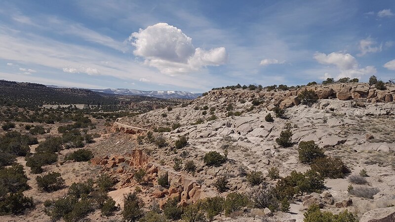
Photo Source: NPS
- Location: Bandelier National Monument
- Trail Length: 1.6 miles
- Trail Type: Loop Trail
- Trail Difficulty: Moderate
- Estimated Time: 1 hour
The Tsankawi Ruins Trail traverses a mostly rocky surface along the way, with tuff or compressed volcanic ash. It’s located in the Bandelier National Monument, which charges an entry fee. The tuff that you tread along is very fragile, so be careful to protect it!
The trail begins in a juniper-pinon forest that leads you to a ladder up the side of the mesa. As you climb, you’ll be rewarded with scenic views of the surrounding canyons.
Finally, you’ll reach the un-excavated Tswankawi Pueblo. You can explore the ruins and see the footsteps of the ancient Puebloans, and modern-day visitors have carved trenches into the soft rock. The end of the trail also features petroglyphs hidden everywhere!
Picacho Peak Trail
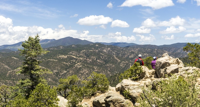
Photo Source: Outdoor Project
- Location: Santa Fe National Forest
- Trail Length: 3.8 miles
- Trail Type: Out-and-back trail
- Trail Difficulty: Moderate
- Estimated Time: 2-3 hours
The Picacho Peak trail is just a section of the 22-mile Dale Ball Trail system that borders the city of Santa Fe. On this day hike, you’ll climb one of the highest hills looming over the town. You’ll be rewarded with spectacular views up and down the last mile of the trail.
Along the hike, you’ll walk through at least three separate ecological zones before the reward of 360-degree views at the peak. Luckily, the Santa Fe trail system is straightforward to navigate. The trail junctions are numbered, and each intersection has a map of the system.
Dale Ball Trails North
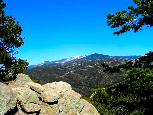
Photo Source: Broken Spoke
- Location: Dale Ball Trails
- Trail Length: 4.4 miles
- Trail Type: Loop trail
- Trail Difficulty: Easy
- Estimated Time: 2 hours
The Dale Ball Trail system is an almost 25-mile network of trails for hikers and bicyclists in the foothills of the Sangre de Cristo Mountains. This trail is the quickest way to get from the city of Santa Fe into the mountains.
Whether you’re a beginner hiker or have years of experience on the trail, there are opportunities for you on the Dale Ball Trail. You’ll be rewarded with amazing views of the surrounding wilderness and the city of Santa Fe.
There are three groups of Dale Ball Trails: North, Central, and South. In general, the trails are more challenging going from North to South. However, central has the most exposed areas, so the North trail is a better option on sunny days.
Winsor Trail
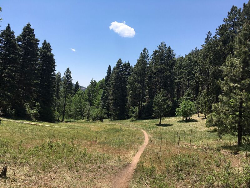
Photo Source: AllTrails
- Location: Santa Fe National Forest
- Trail Length: 5.8 miles
- Trail Type: Out-and-back
- Trail Difficulty: Moderate
- Estimated Time: 2-3 hours
There’s a great route on the Winsor Trail that is a short out-and-back on the much longer trail. It begins next to the Santa Fe Ski Area parking lot. Right away, you’ll start to ascend a rocky and technical section, of course. After about 1.5 miles, the trail becomes less technical. Remember that the altitude is above 10,000 feet, so you may need some time to get acclimated!
At a lower elevation, the Winsor Trail crosses back and forth over Tesuque Creek several times. It offers beautiful forest and creek views as well as plenty of shade. If you’re looking for a trail with a vastly different landscape than most of Santa Fe, this trail is for you!
Atalaya Mountain Trail
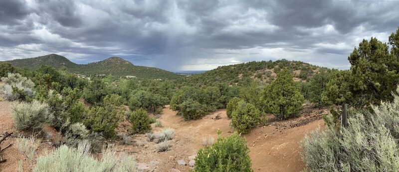
Photo Source: AllTrails
- Location: Santa Fe National Forest
- Trail Length: 6.2 miles
- Trail Type: Out-and-back trail
- Trail Difficulty: Moderate
- Estimated Time: 4 hours
The Atalaya Mountain Trail is situated in the Santa Fe National Forest. It’s a popular day hike that boasts incredible views just outside the city of Santa Fe, New Mexico. The hike begins at the Atalaya Mountain trailhead parking lot at St. John’s College.
This trail is well-used singletrack that takes you through the forest and up Atalaya Mountain. Along the way, plenty of steep hillsides offer spectacular views of the town of Santa Fe.
The trail is well used and is nice singletrack winding through the forest. Some places contour around steep hillsides offering views down toward town. The higher you go, the steeper it gets until you top out on a more level view spot.
About halfway up the trail to the summit, there are two options: a steeper and a less steep but more prolonged option. Either route you take, they eventually rejoin.
Nambe Lake Trail
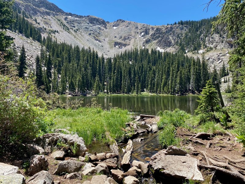
Photo Source: Hiking Project
- Location: Santa e National Forest
- Trail Length: 6.7 miles
- Trail Type: Out-and-back
- Trail Difficulty: Difficult
- Estimated Time: 4-5 hours
The Nambe Lake Trail leads hikers above the high desert of Santa Fe and into the alpine beauty of the Sangre de Cristo Mountains. The best part? You can get this alpine landscape from the trailhead which is only a half-hour drive from the city!
The trail begins at the Santa Fe Ski Basin parking lot and leads you through the Sangre De Cristo subrange of the Southern Rockies. The first part of the trail is pine forest covered and mostly shade, and it offers some views of the valley and Mt. Baldy.
Once you begin the uphill, it’s a steep climb. At the top is Nambe Lake, a relatively small and shallow lake. Take the trail winding around the lake to see beautiful views of the mountains above!
Tesuque and Aspen Vista Loop
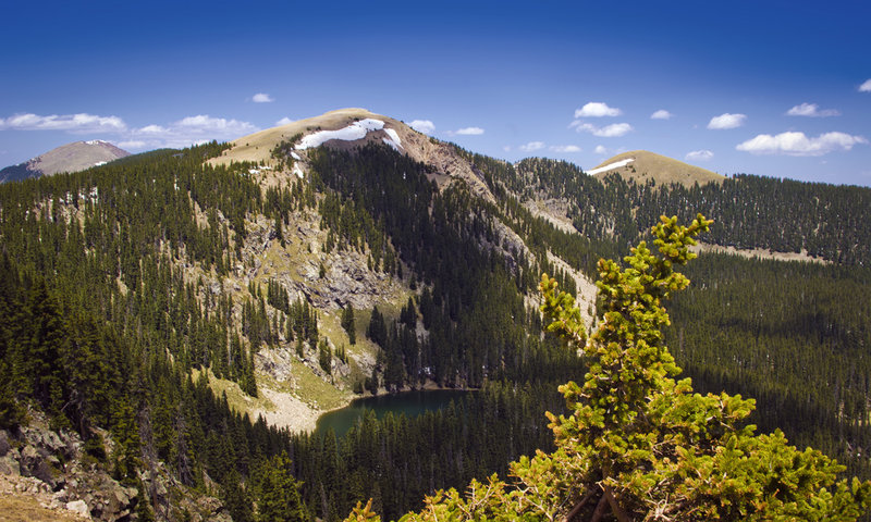
Photo Source: Hiking Project
- Location: Santa Fe National Forest
- Trail Length: 7.6 miles
- Trail Type: Loop trail
- Trail Difficulty: Difficult
- Estimated Time: 5 hours
The Tesuque and Aspen Vista Loop offers a fun-filled adventure through the Santa Fe wilderness. If you’re up for a beautiful and challenging endurance hike, the Aspen Vista Trail is the route for you!
This trail offers many natural features, including wildflower fields, a river, a waterfall, and a lake. Along the way, the hike consistently yet gradually gains elevation towards the summit of Tesuque Peak. It can be too much for inexperienced hikers. But if you’re up for the challenge, you’ll be rewarded with incredible views!
Willow Lake Trail
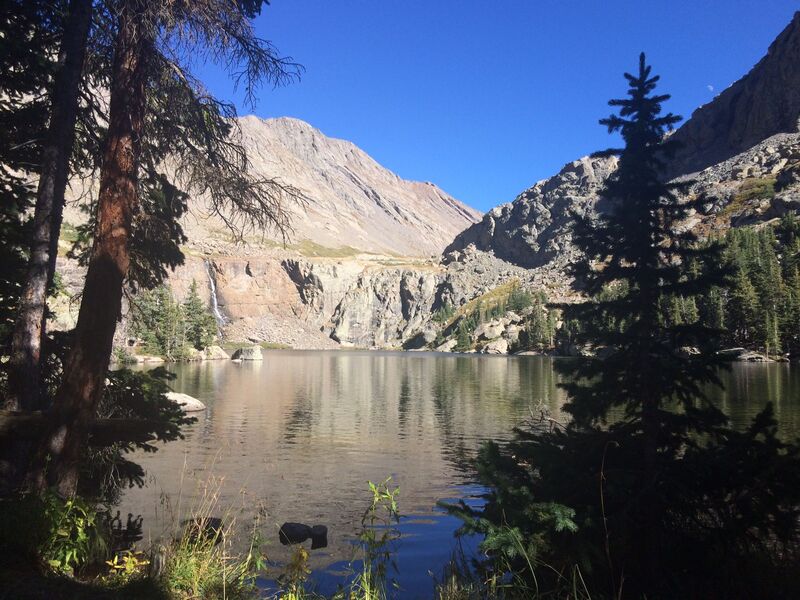
Photo Source: AllTrails
- Location: Sangre de Cristo Wilderness
- Trail Length: 10.2 miles
- Trail Type: Out-and-back
- Trail Difficulty: Difficult
- Estimated Time: 5-6 hours
Willow Lake is situated in southern Colorado’s heart of the Sangre De Cristo mountains, just a short road trip from Santa Fe. The trailhead is located east of Crestone, Colorado, and takes you on a journey through forests of fir, arbors of aspen, and fields of scree.
Willow Lake is a reservoir for the waters draining the Obstruction Peak glacial trough as they rush north and west toward the central Colorado basin. Therefore, the season that you decide to hike this trail is important. Depending on the time of year, the streams you encounter along the way will be either trickles or torrents.
In about 2.5 hours, you can climb to the west end of Willow Lake. Then, within another 30 minutes, you can reach the waterfall at the east end of the lake. From here, you have spectacular views of Challenger Point, Kit Carson Mountain, and Obstruction Peak.
What to Bring: Recommended Gear for Hiking in Santa Fe
Preparing for your day hike in Santa Fe is essential for a great experience. Before setting out on the trail, you should always check the weather and trail conditions. Check out this list of recommended hiking gear.
Hiking Boots: Comfortable, supportive, and durable footwear will be necessary for hiking in Santa Fe. For more technical climbs, you should consider wearing approach shoes. (Check out recommendations for the Best approach shoes).
On more accessible hikes around Santa Fe, quality hiking sandals are also a great option. (Check out recommendations for Hiking Sandals for women).
Rain Jacket: A rain jacket is highly recommended if you’re hiking in the spring or fall seasons. You don’t want to be caught unprepared during a surprise rain shower!
Sun Protection: Make sure you have everything you need to protect yourself from harmful sun rays! A sunhat, sunglasses, UPF clothing, and sunscreen are all great options. Long sleeves and pants are also a good idea. Here are some recommendations for Hiking pants for men.
Warm Layers: When the sun goes down, you’ll want to ensure you have enough warm layers. Pack a shell to protect you from rain and wind and an insulating layer to keep you warm. And check the weather and temperature forecasts before you go.
Day Pack: You’ll need a comfortable and durable daypack to store any goodies you need throughout the day! Warm layers, water, snacks, and your maps will all need to fit here.
Water: Especially during the spring and summer, always ensure you have plenty of water and a reusable water bottle for your hiking adventure. It’s also a good idea to carry a water filter or another form of treatment if you get in a pinch.
Nutrition: Don’t forget your lunch and trail snacks! You’ll want to keep your body fueled all day long. try panda express nutrition
Trail map: Even if you’re familiar with the hiking trail, it’s a good idea always to bring a paper trail map and compass.
First aid kit: You never know what could happen out on the trail! So be prepared for injury or illness by packing a first aid kit.
Why Hike in Santa Fe?
One of the best things about hiking in Santa Fe is the variety of landscapes you can walk through. The varied terrain and natural features make you feel like you’re hiking somewhere new each time! In addition, you can go on so many unique hikes without having to drive a great distance between them.
Is Santa Fe National Forest Open for Hiking?
According to the US Forest Service, Many areas of the Santa Fe National Forest reopened on Friday, June 24. However, some places will remain closed; review the conditions for the recreation area you wish to visit.
What are the Different Types of Hiking Trails in Santa Fe?
Many people don’t realize that New Mexico has a lot of areas of high elevation. So while you may expect always to be hiking through a hot desert landscape in Santa Fe, that’s not always the case! This can even result in snow and cold weather in places you wouldn’t expect.
As you can see, Santa Fe boasts so many unique opportunities. There’s a rich history and many historical sites and ruins to see. If you want to hit the city, you can visit one of the many art museums or restaurants. There are also endless opportunities for hiking and outdoor adventures-whether you want to walk through a dense forest, a desert, or something in between!


Leave a Reply