Palm Springs is a unique southern California resort city with a lot to offer. Situated about two hours east of Los Angeles, the stunning terrain of Palm Springs is a result of the four different surrounding mountain ranges: San Bernadino, Santa Rosa, San Jacinto, and Little San Bernadino Mountains. The nearby Coachella Valley adds another element of incredible beauty. With more than 100 hiking trails for all experience levels, you really can’t go wrong hiking in Palm Springs!
But Palm Springs is so much more than just a top desert hiking destination. There’s something for everyone in the family! So whether you want to relax by the pool at a resort, go shopping at the mall, or make your way over to nearby Joshua Tree National Park– it’s all ready and waiting for you in Palm Springs!
Keep reading if you’re ready to plan your next Palm Springs hiking adventure! We’ve gathered the best hiking trails in Palm Springs for any experience level.
Table of Contents
Easy Hikes in Palm Springs
Andreas Canyon Trail
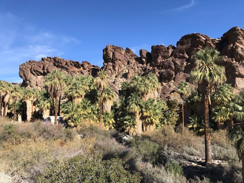
Image Source: AllTrails
- Location: Indian Canyons Tribal Area
- Trail Length: Approximately 2 miles
- Trail Type: Loop Trail
- Trail Difficulty: Easy
- Estimated Time: 1 hour
There’s lots of water on this desert hike- need we say more? For many good reasons, Andreas Canyon is one of the more popular hiking trails in the Indian Canyons region. First, the Indian Canyons area is a protected nature reserve on Native American land. There is a $12 for admission into this preserve, but many hikers agree that it’s well worth the cost!
The Andreas Canyon Trail is the world’s second-biggest California Fan Palm oasis. And you know what that means- lots of water! The gentle hike follows a gorgeous natural spring and only gains about 200 feet in elevation.
There is a large parking area at the trailhead for Andreas Canyon, and the trail is well-marked and maintained. It’s a great family-friendly hike located just 15 minutes south of downtown Palm Springs.
Palm Canyon Trail
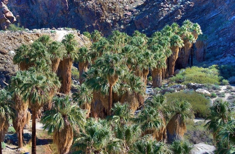
Image Source: Trip Advisor
- Location: Indian Canyons Tribal Area
- Trail Length: Approximately 2 miles
- Trail Type: Out-and-back trail
- Trail Difficulty: Easy
- Estimated Time: 1 hour
The Palm Canyon Trail is an oasis hike that takes you on a scenic route through Palm Canyon. It also allows you to walk through the world’s largest California fan palm oasis! The plentiful Palm Canyon Creek flows through here, providing for the thousands of beautiful palm trees. Bring a picnic lunch and relax at one of the picnic areas near the creek. You’ll enjoy the shade that large palm trees provide throughout the length of the hike!
This trail is most rewarding when done in the winter and spring months when temperatures are more moderate. There is an admissions fee because this trail is located within the Indian Canyons Tribal Area. Also, bicycles and pets are not allowed within this area.
Tahquitz Canyon Loop Trail
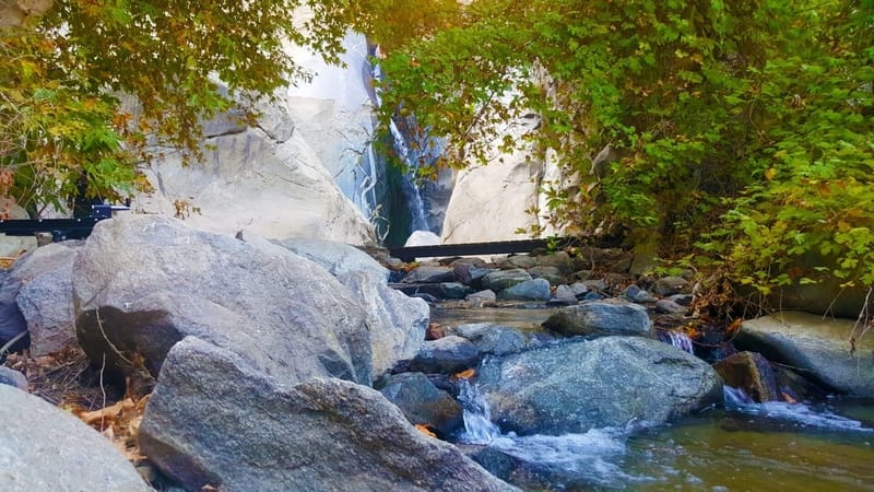
Image Source: Visit Palm Springs
- Location: Santa Rosa and San Jacinto Mountains National Monument
- Trail Length: Approximately 2 miles
- Trail Type: Loop trail
- Trail Difficulty: Easy
- Estimated Time: 1 hour
The Tahquitz Canyon Loop Trail is part of the Agua Caliente Band of Cahuilla Indians Reservation. However, the trail is in the Indian Canyons preserve area. You should check out the Tahquitz Canyon visitor center, which displays artifacts and a theater showing a documentary about the canyon.
The Tahquitz Canyon Trail hike will take you through ancient pictographs, ancient agricultural water canals, and lots of plants and wildlife. The trail eventually leads you to a stunning 60-foot-tall waterfall.
In total, the Tahquitz Canyon Trail is a two-mile hike. It takes you from the visitor center to the waterfall and back. The total elevation change is about 350 feet. There are some steep rock steps, so hikers should use caution.
Moderate Hikes in Palm Springs
Araby Trail
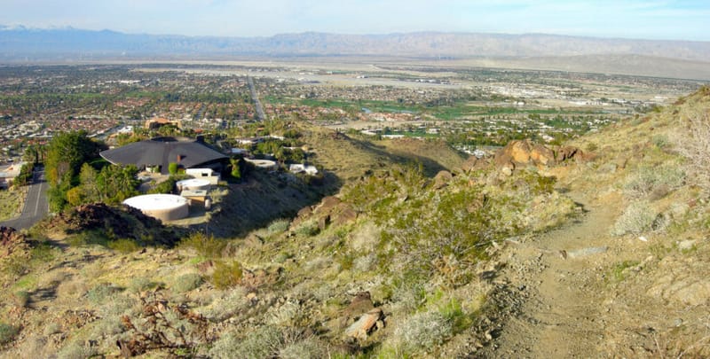
Image Source: Uken Report
- Location: Santa Rosa and San Jacinto National Monument
- Trail Length: Approximately 4 miles
- Trail Type: Out-and-Back Trail
- Trail Difficulty: Moderate
- Estimated Time: 2 hours
The Araby Trail is a popular trail area for hiking, bird-watching, and horseback riding. Along the way, you’ll stroll into the Araby Cove on the eastern side of Palm Springs. The Araby Trail features the stunning natural beauty of the Santa Rosa Mountains and surrounding vistas. Cholla cacti and mesquite will also be plentiful throughout this scenic hike.
The first ¼ mile climbs above a residential area. You may not know it, but you’ll also be embarking on a celebrity house tour on this hike! You’ll walk past homes once owned by Bob Hope and Steve McQueen. If that doesn’t interest you, don’t worry. The trail highlights begin as you climb beyond the residential area. You’ll hike uphill for almost 2 miles along the rocky mountainside, making this trail doable for most reasonably fit people.
The trail has a total of 1364 feet of elevation gain with very little shade- so be sure to pack plenty of water! Because of this, the best time to visit this trail is from September through April. Also, dogs are allowed on just part of this trail. Be sure to adhere to the signs that indicate dogs are no longer allowed.
There’s a small parking lot for the Araby Trail located near Rim Road. The trailhead is just a short walk up the road. The parking lot fills up quickly, so start your hike early!
Murray Canyon Trail
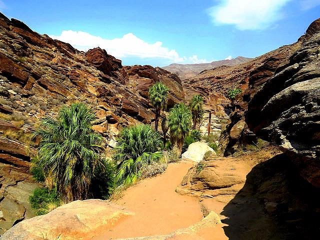
Image Source: Trip Advisor
- Location: Indian Canyons Tribal Area
- Trail Length: Approximately 5 miles
- Trail Type: Out-and-back trail
- Trail Difficulty: Moderate
- Estimated Time: 2 hours
The Murray Canyon Trail is nearly five miles long, and it’s located in the Indian Canyons Tribal Area. So technically, it takes you on two trails: the Murray Canyon Trail and the Coffman Trail.
The hike begins as you walk about a mile through a vast, open desert landscape. Once you arrive at Murray Canyon, you’ll see a stream running through it. The trail crosses that stream multiple times. As you continue along the path, you’ll encounter some fantastic rock formations as you go! And the highlight? The 15-foot-tall Seven Sisters Waterfall is the endpoint of the Murray Canyon Trail.
This trail is a bit farther out and less traveled than other trails in the Indian Canyons area. You may even see a bighorn sheep or a mule deer above the canyon! However, because the Murray Canyon Trail is within the Indian Canyons Tribal Area, you’ll have to pay an admittance fee to enter.
South Lykken Trail
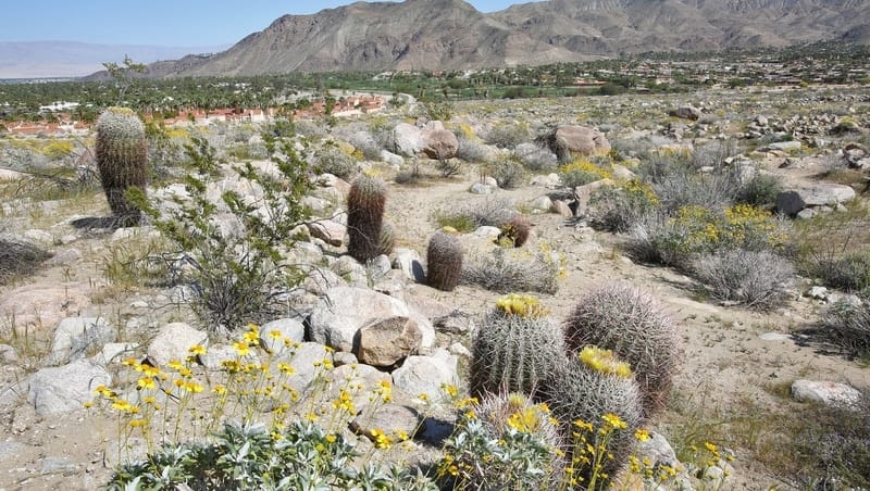
Image Source: The Desert Sun
- Location: Santa Rosa and San Jacinto Mountains National Monument
- Trail Length: Approximately 9 miles
- Trail Type: Out-and-back trail
- Trail Difficulty: Moderate
- Estimated Time: 5 hours
The South Lykken Trail is considered one of the best trails in Palm Springs! This moderately challenging trail is a great workout. It’s also a great place to see the incredible local flora and fauna! Many hikers see bighorn sheep, numerous lizards, roadrunners, and interesting cacti species.
The South Lykken Trail is rocky, but the stunning vistas make it worth it! The views to the east are of Palm Springs and the valley. There’s a steep incline at both the beginning and end of the trail, but it’s a moderate hike in between. There is also a great picnic area at the halfway point!
There is almost no shade along the South Lykken Trail, so be sure to wear plenty of sun protection! If you park near Tahquitz Canyon, you can walk back to the parking area for about 2 miles.
Difficult Hikes
Hahn Buena Vista Loop Trail
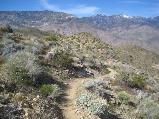
Image Source: Single Tracks
- Location: Santa Rosa and San Jacinto Mountains National Monument
- Trail Length: Approximately 12.5 miles
- Trail Type: Loop trail
- Trail Difficulty: Difficult
- Estimated Time: 6 hours
The Hahn Buena Vista Loop Trail is Indian Canyon’s most strenuous trail. However, it rewards hikers with its spectacular views. It’s considered one of the most scenic trails in the Santa Rosa Mountains! The course begins across from the Art Smith trailhead. It then climbs for about a mile to a stunning vista, where you’ll see the entire desert floor below you. Finally, the trail ends at a peak with incredible 360-degree views of the whole Coachella Valley. You really can’t beat that view! You’ll gain 2,204 feet over the Hahn Buena Vista Loop Trail.
This trail is excellent for hiking, mountain biking, and trail running. Because of its challenge, you won’t encounter many other people while exploring. The best time to hike it is October through April.
Mt San Jacinto Peak Hike
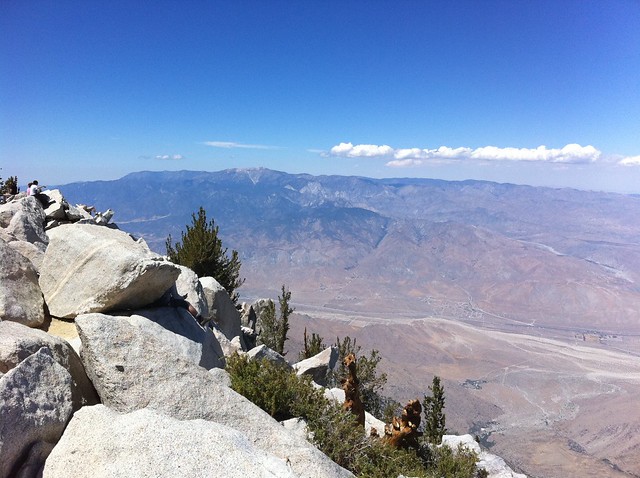
Image Source: Modern Hiker
- Location: Mountain Station
- Trail Length: Approximately 11 miles
- Trail Type: Out-and-Back Trail
- Trail Difficulty: Difficult
- Estimated Time: 6 hours
The Mt San Jacinto Peak Hike begins at the Mountain Station of the tramway. The hike ends at the summit of Mt. San Jacinto, which is the second-highest point in Southern California. It’s about 10,000 feet above sea level!
You’ll be in awe of the stunning, endless views that stretch across the area. If you decide to hike at night or in the early morning, you can even see the Las Vegas city glow- and that’s about 300 miles away!
The San Jacinto Peak hike is popular for people who take the Palm Springs Aerial Tramway instead of doing the entire walk. They start at the tramway’s mountain station, and it takes you about 8,500 feet to the top of the mountain. From there, you have an elevation gain of about 2,600 feet.
Skyline Trail (Cactus to Clouds Trail)
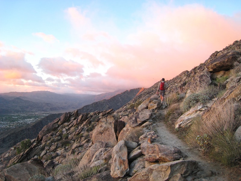
Image Source: I Hike San Diego
- Location: Mount San Jacinto State Park
- Trail Length: Approximately 21 miles
- Trail Type: Point-to-Point Trail
- Trail Difficulty: Difficult
- Estimated Time: 15 hours
The Cactus to Clouds Trail is also known as the Skyline Trail. It’s only for prepared and experienced hikers, as it provides one of the most extreme changes in elevation in any day hike in the United States. In total, you gain an incredible 10,300 feet! The trail truly takes you from the cactus of the desert floor clouds of the peak of Mt. San Jacinto.
At about 21 miles, it truly is an all-day hike. It typically takes around 14-15 hours to complete. The hike is best done in the spring or fall because of the extreme weather at both ends of the Cactus to Clouds Trail. Even then, many hikers choose to start at night.
Wilderness permits are required for this hike, and they’re free and available at the kiosk in the parking lot. There’s also a $ 10-day use fee for parking in the Stone Creek campgrounds day-use parking lot.
Hiking in Palm Springs: FAQ
Where are the best places to stay in Palm Springs?
Luxury Hotels
Check out the four-star The Willows if you want to pamper yourself after a long day on the trail. Then, for a country estate-like experience, book with the Ingleside Inn, located in downtown Palm Springs.
Budget Hotel Options
The two-star Caliente Tropics Resort is affordable, fun, and pet-friendly. Another excellent budget option is the Skylark Hotel.
Camping Options
Are you planning to camp in Palm Springs? The Palm Springs/Joshua Tree KOA located in the nearby Desert Hot Springs maybe your spot! However, if you’re looking for a more primitive camping experience, Lake Cahuilla Recreation Area has beautiful sites in the Coachella Valley.
How do I add a day hike into my travel plans to Palm Springs?
The easiest way to add hiking to your Palm Springs trip is to do a short, local day hike. The Palm Springs Museum Trail is an excellent option as it’s quick, scenic, and located downtown.
What should I wear hiking in Palm Springs?
No matter the time of year, there’s a good chance it’ll be warm and sunny in Palm Springs. Sun protection is the most significant factor to consider when planning what to wear to hike. Bring a sun hat, and consider wearing light-colored long-sleeves and pants to protect you. Any clothes with built-in UPF protection are always a plus!
Durable footwear is also essential for hiking in Palm Springs. Hiking boots may be too heavy and not very breathable, but comfortable trail runners are a great option.
What’s the weather like in Palm Springs?
The hottest months are June through September, when temperatures average nearly 100 degrees. The cool months are November through February, and temperatures are typically mid-70s. Therefore, the best time to visit Palm Springs is between January and April.
What else can I do in Palm Springs?
Hiking is just one of the many fun things in Palm Springs. In addition, you can get out of the heat and ride the Palm Springs Aerial Tramway. If you want to do more exploring outdoors, check out the Coachella Valley Preserve. Palm Springs is also home to many incredible museums, including the Palm Springs Art Museum Architecture and Design Center, Palm Springs Art Museum, and Palm Springs Air Museum.
Before You Go: Recommended Gear for Hiking in Palm Springs
Anytime you’re hiking around Palm Springs, you’ll embark on a desert hike adventure. With this in mind, there are some important considerations for your packing list. Here are some essential items you can’t leave behind when planning a hiking trip in Palm Springs!
- Plenty of water: Bring at least 2 liters—plan to drink ½-1 liter of water per hour of hiking.
- Snacks: Always bring extra to keep your body nourished!
- Sun Protection: You should always wear a sunhat while hiking in Palm Springs- the sun isn’t forgiving to anyone! Bring lots of sunscreens and other sun-protective clothing if you have them.
- Map and compass: It’s always best to be prepared; you may lose cell service and need to rely on maps to get around.
- First Aid Kit: You never know what may happen on the trail! Whether you brush up against a cactus or get stung by an insect- your first aid kit will help out.
Plan Your Palm Springs Adventure
What are you waiting for now that you know where to stay and which hiking trails you want to hit? It’s time to start planning your trip to Palm Springs! No matter the time of year, Palms Springs is ready to welcome you with all it offers.


Leave a Reply