Baltimore is a historic city with a bustling art and culture scene. While the city is best known for its Inner Harbor, many more hiking spots exist to explore. This area of Maryland is defined by its many waterways and coasts on the Chesapeake Bay and the Atlantic Ocean. It’s also home to many of the state’s beloved state parks. The Appalachian Trail also runs near Baltimore, providing convenient access to the foothills.
Hiking near Baltimore provides a fantastic way to get outside and experience nature. With forests, lakes, waterfall hikes, and canyons just miles from the city, it’s easy and convenient to hit the trail. Whether you’re interested in a day trip before grabbing a craft brew or setting off on a multi-day backpacking trip, there are miles of trails for you to explore. To get you started on planning your next outdoor adventure, here are the best hikes near Baltimore to help you prepare.
Table of Contents
Easy Hikes Near Baltimore
Swallow Falls Canyon Trail
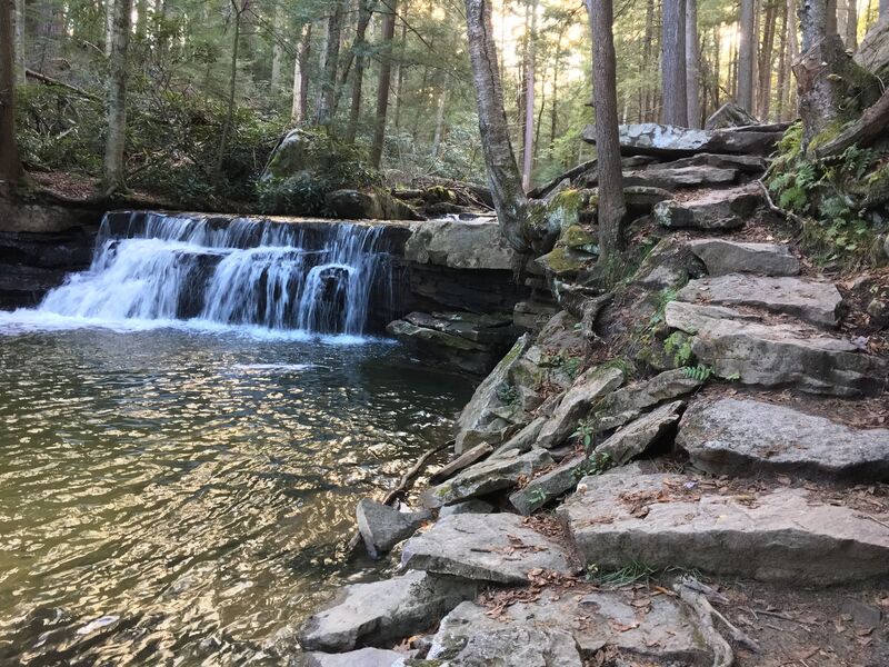
Image Source: AllTrails
- Location: Swallow Falls State Park
- Trail Length: 1.1 miles
- Trail Type: Loop trail
- Trail Difficulty: Easy
- Estimated Time: ½ hour
The Swallow Falls Canyon Trail is an easy one-mile hike near Baltimore. Nestled in the Swallow Falls State Park, this trail offers people of all hiking levels views of picturesque waterfalls, canyon-like rocks, and serene forests. Come hike in the summer to experience one of the stunning wildflower hikes in Maryland.
The Swallow Falls Canyon Trail is a perfect destination for a waterfall road trip. It’s a well-maintained trail that’s both dog and kid-friendly. It’s also an excellent opportunity to try out a new pair of hiking sandals.
Remember that the parking lots fill up quickly, so make sure to start early. But, even if you only have time for a quick day hike, the scenic river and falls are well worth the visit.
Kilgore Falls
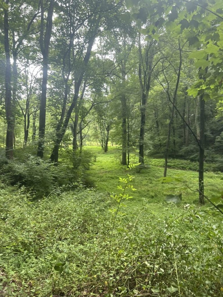
Image Source: AllTrails
- Location: Rocks State Park
- Trail Length: 1.3 miles
- Trail Type: Out-and-back trail
- Trail Difficulty: Easy
- Estimated Time: ½ hour
The short-and-sweet hike to Kilgore Falls is perfect for both families and adventurous hikers. Although the walk is short, it’s a fun stroll to a stunning waterfall within Rocks State Park. The trail is easy and flat and accessible for kids and beginner hikers. It also loops above and around the falls, so don’t miss out on this section to experience breathtaking views of the beautiful cascade.
Kilgore Falls is Maryland’s second-highest vertical waterfall in the Falling Branch area of Rocks State Park. This hiking spot was once a meeting place for Susquehannock Native Americans.
Lake Roland Park Red Trail
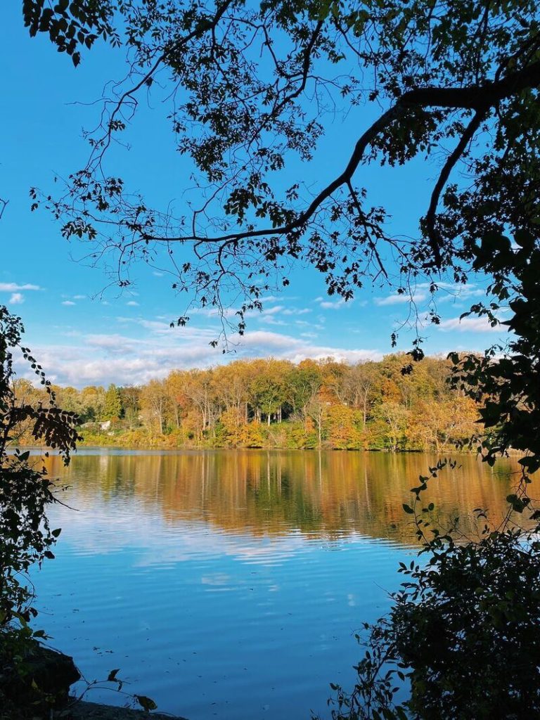
Image Source: AllTrails
- Location: Lake Roland Park
- Trail Length: 2.7 miles
- Trail Type: Loop trail
- Trail Difficulty: Easy
- Estimated Time: 1 hour
Lake Roland is one of the many beautiful public parks in the Baltimore area. The park offers a wide variety of trail options, and the Red Trail is among the most popular. The Red Trail can be bumpy in certain areas but stays flat and reasonably wide throughout the route.
The Lake Roland Park Red Trail follows an old train line, so you’ll see historic sites and remnants along the way. In the first section of the trail, you’ll stroll by the picturesque Jones Falls. After the bridge, you’ll encounter the intersection of many other trail options. Choose your own adventure!
Baltimore Waterfront Promenade
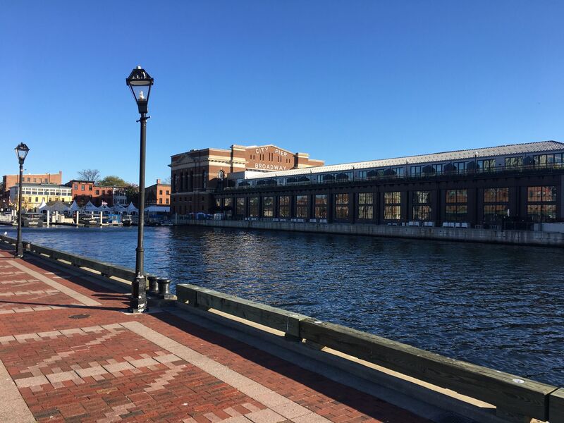
Image Source: AllTrails
- Location: Canton Waterfront Park
- Trail Length: 4.7 miles
- Trail Type: Out-and-back trail
- Trail Difficulty: Easy
- Estimated Time: 1 ½ hours
The Baltimore Waterfront Promenade is one of the best scenic hiking trails along the water. The section from Canton Waterfront Park to Fells Point is a leisurely and beautiful stroll. On a sunny afternoon, the waterfront is the perfect hike for the whole family.
The path is a paved walkway that covers a total of seven miles along the shoreline of the Inner Harbor from Fort McHenry to the Canton Waterfront Park. You’ll pass by restaurants, historic sights, and scenic parks during your stroll.
Moderate Hikes Near Baltimore
Cascade Falls Loop Trail
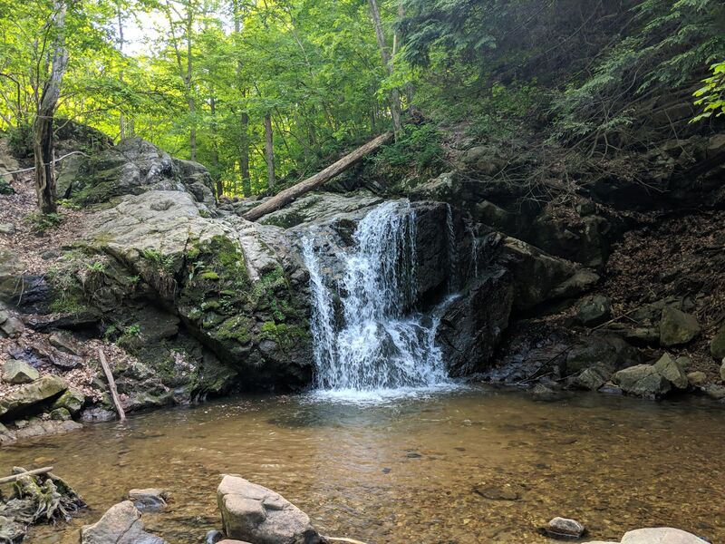
Image Source: AllTrails
- Location: Patapsco Valley State Park
- Trail Length: 2.3 miles
- Trail Type: Loop trail
- Trail Difficulty: Moderate
- Estimated Time: 1 hour
The Cascade Falls Loop Trail is a great hiking spot for the whole family, dogs included. It’s a relatively flat trail with a few stream crossings within the Patapsco Valley State Park. However, the trail can be wet and muddy after rainfall, so it’s a good idea to wear waterproof hiking shoes.
The Cascade Falls Loop Trail leads you to a small but scenic waterfall through the forest trees. Cascade Falls can be crowded, especially on weekends. But, despite the crowds, this trail is an excellent escape from the city and into the outdoors!
Annapolis Rock via the Appalachian Trail
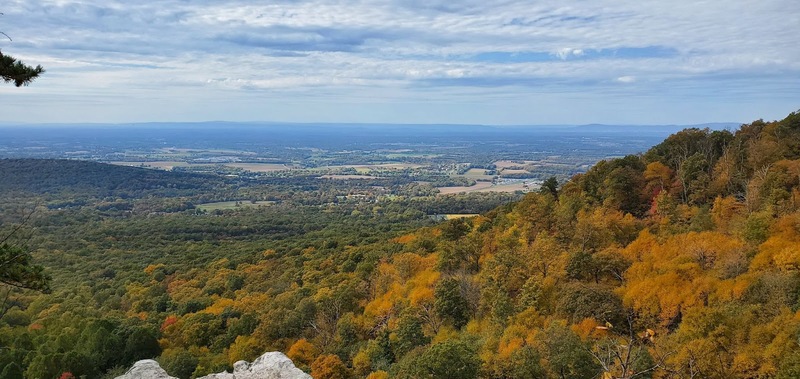
Image Source: AllTrails
- Location: South Mountain State Park
- Trail Length: 5 miles
- Trail Type: Out-and-back trail
- Trail Difficulty: Moderate
- Estimated Time: 2 ½ hours
If you’ve been dreaming of stepping on the Appalachian Trail, this trail is for you!
The Annapolis Rock Trail features amazing birds-eye views of the surrounding mountains. You’ll have a 2.5-mile ascent to a rocky outcropping overlooking the surrounding Appalachian Mountains within Annapolis Trail Park.
The climb to the viewpoint may be steep, but the breathtaking views at the top are absolutely worth it. The hike to Annapolis Rock is one of the most popular hikes near Baltimore. Make sure to get an early start or hit the trail on a weekday to avoid the crowds.
Chevrolet Trail Loop
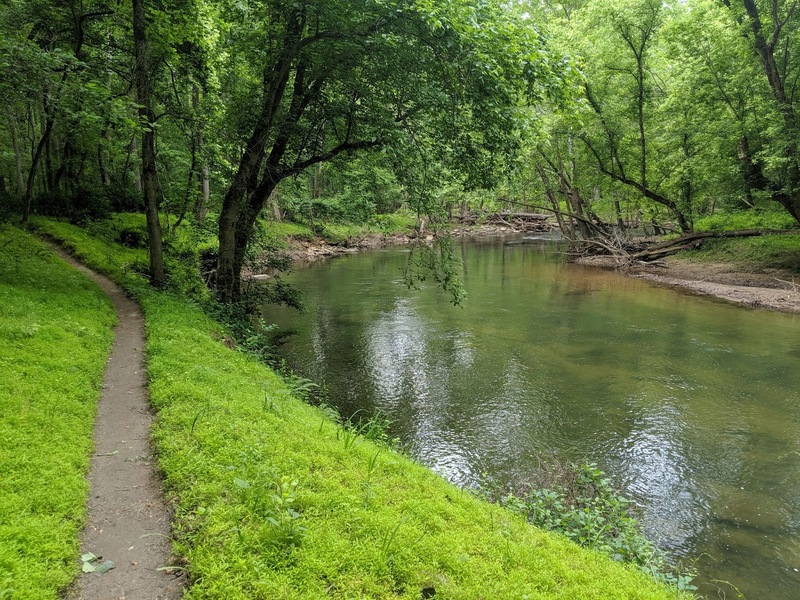
Image Source: AllTrails
- Location: Patapsco Valley State Park
- Trail Length: 6.2 miles
- Trail Type: Loop trail
- Trail Difficulty: Moderate
- Estimated Time: 2 hours
The Chevrolet Trail Loop is a great hidden gem hike nestled in the Patapsco Valley State Park. It’s a well-marked and maintained trail ideal for hiking and trail running, although it is a multi-use trail. If you want to get the elevation gain out of the way initially, hike this trail counterclockwise.
Patapsco Valley State Park is a very popular area for hiking, mountain biking, and running. To access the trail, it’s recommended to park across the street from Woodstock Inn in the designated parking lot and walk across the bridge.
Paw Paw Tunnel Trail
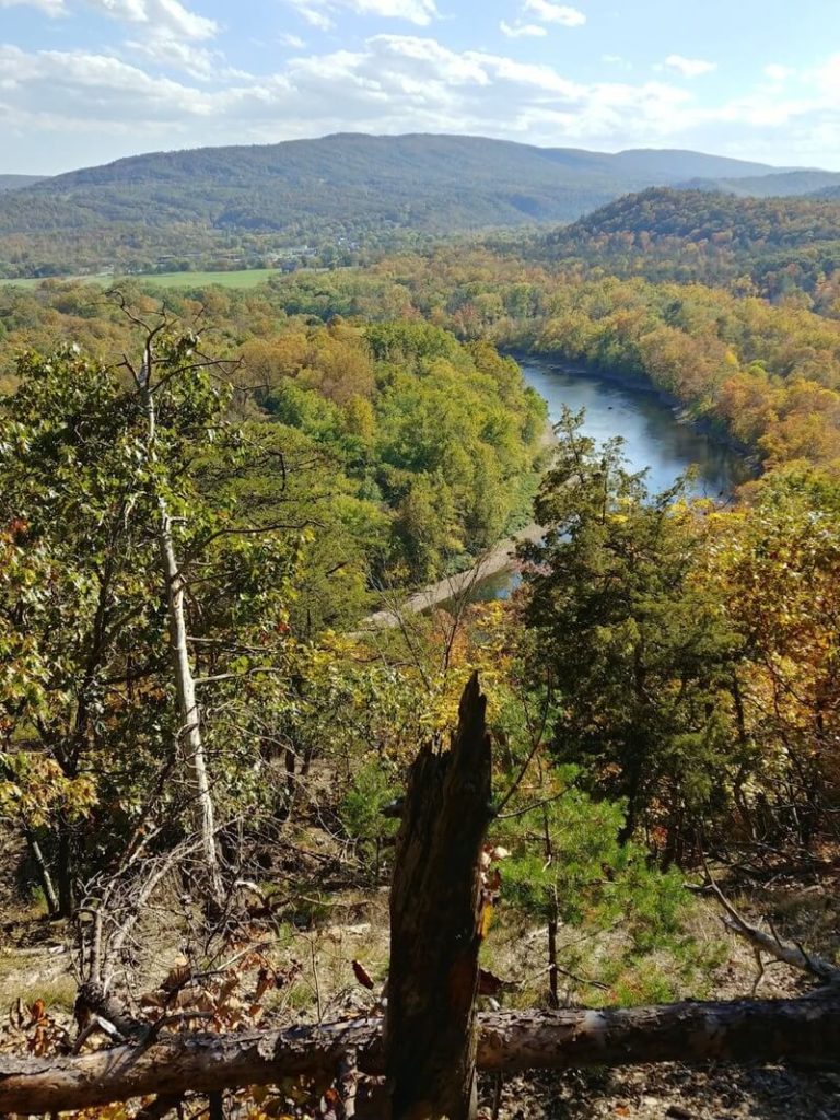
Image Source: AllTrails
- Location: Chesapeake and Ohio Canal National Historic Park
- Trail Length: 6.4 miles
- Trail Type: Out-and-back trail
- Trail Difficulty: Moderate
- Estimated Time: 3 hours
The Paw Paw Tunnel Trail is a great option if you’re hoping for a historical day trip. The trail follows a former railroad tunnel that was later turned into a hiking path. Waterfalls surround the trail if hiking through a tunnel isn’t unique enough. You can’t find another unique and picturesque setting quite like this one.
There’s a fee to enter the C&O Canal National Historical Park, where the trailhead is located. You can also purchase a park-specific annual pass. Be sure to pack a flashlight with you, as it’s dark in the tunnel at any point in the day!
Challenging Hikes Near Baltimore
Maryland Heights Loop
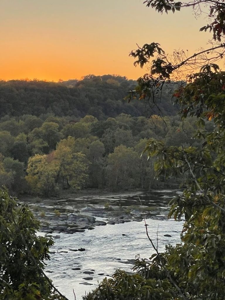
Image Source: AllTrails
- Location: Harpers Ferry National Historical Park
- Trail Length: 6.6 miles
- Trail Type: Loop trail
- Trail Difficulty: Hard
- Estimated Time: 3 ½ hours
The Maryland Heights Loop is situated within Harpers Ferry National Historic Park. It’s an essential landmark of the Civil War. This area is also the point where the Potomac and Shenandoah Rivers converge, as well as the borders of three states – Maryland, Virginia, and West Virginia. Although Harpers Ferry is in a different state, it’s less than two hours from the city.
Whether you’re looking for a challenging day trip or a weekend getaway, the Maryland Heights Loop is a fantastic option. Two available trails stem from the Maryland Heights trailhead; the overlook and the entire trail. The shorter path brings you to the most stunning views in the whole park- a birds-eye view of the convergence of the rivers and town of Harpers Ferry and the historic iron bridges that lead into it.
Pinnacle Overlook via Conestoga Trail
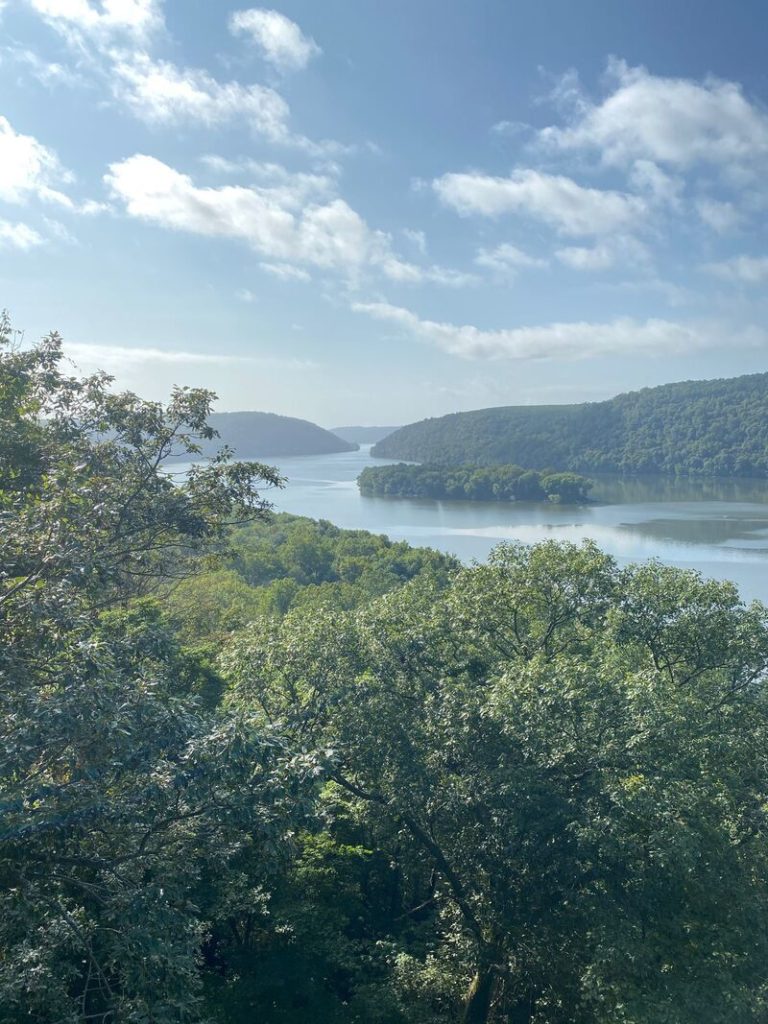
Image Source: AllTrails
- Location: Conestoga, PA
- Trail Length: 10.3 miles
- Trail Type: Out-and-back trail
- Trail Difficulty: Hard
- Estimated Time: 6 hours
The Conestoga Trail is a challenging yet rewarding hike within driving distance of Baltimore near Lancaster, PA. The Pinnacle Overlook is along the Conestoga Trail. This hike takes you to unique and beautiful views over the Susquehanna River.
The terrain along this trail can be pretty rocky and challenging. It’s not suite for beginners, but it’s great for experienced hikers that want a challenge with breathtaking views. Consider hiking the Conestoga Trail in a pair of approach shoes. Park at the boat ramp to hike the entire trail out and back.
Catoctin Trail
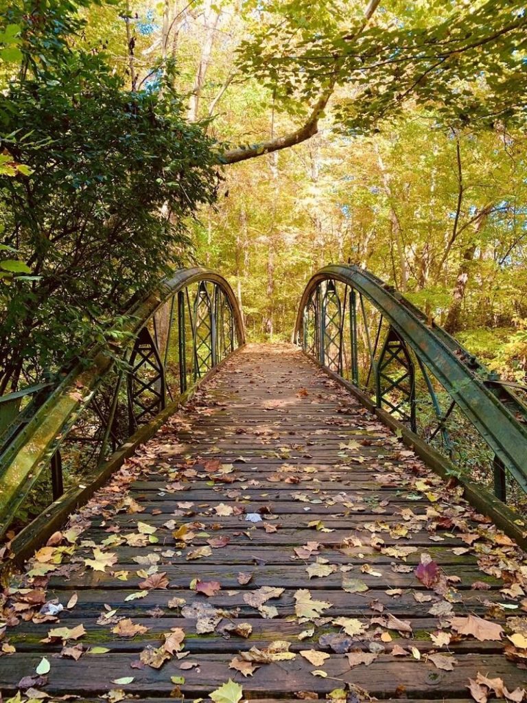
Image Source: AllTrails
- Location: Cunningham Falls State Park
- Trail Length: 10.8 miles
- Trail Type: Point-to-point trail
- Trail Difficulty: Hard
- Estimated Time: 5 ½ hours
The Catoctin Trail is a stunning point-to-point trail nestled within the Cunningham Falls State Park. This challenging hike features many bridges, varied terrain, and opportunities to view wildlife. While it’s strenuous, it’s well worth the effort.
While the Catoctin Trail isn’t recommended for beginners, it’s well-suited for intermediate and advanced hikers. The first 2 miles are all uphill and can be very strenuous. After that, the route is technically easy. Because of its challenge and distance, you may not run into many other hikers on this trail.
Avalon Loop Trail
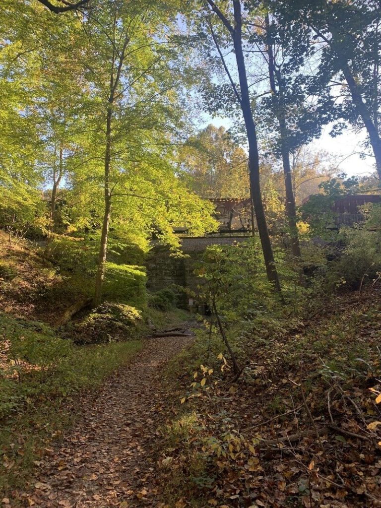
Image Source: AllTrails
- Location: Patapsco Valley State Park Avalon Area
- Trail Length: 20 miles
- Trail Type: Loop trail
- Trail Difficulty: Hard
- Estimated Time: 8-9 hours
The Avalon Loop Trail traverses most of the Avalon Area within the Patapsco Valley State Park. Along the way, you’ll pass by multiple ruins, waterfalls, and other artifacts along the path. Historic settler homes, old gas pumps, and other building ruins can also be viewed along this trail.
This trail also takes you to Cascade Falls, home to one of the best falls in Maryland. The falls are nestled in a secluded valley, making the Avalon Loop a hidden gem hike. If you’re up for even more of a challenge, you can hike an additional loop trail that features more ruins.
Hiking in Baltimore FAQs
Is there hiking in Baltimore?
Yes, there are plenty of opportunities to hike in and around Baltimore. From leisurely strolls around the water with the family to scenic waterfall hikes to strenuous hikes in the mountains, there is a hike for everyone in Baltimore.
What’s the highest point in Baltimore city?
The highest point in Maryland is Hoye Crest. It sits 3,360 feet above sea level on Backbone Mountain in Garrett County.
Are there mountains in Baltimore?
There are four named mountains in Baltimore. Bend Hill is the highest peak, and the most prominent mountain is Federal Hill. There’s also Prospect Hill and Tank Hill.
As one of the most charming towns in Maryland, Baltimore draws in crowds from all over the country. There’s so much to explore, from art shows and museums to craft breweries and boardwalks. But to add to your city experience, you only need to take a step outside to check out what nature offers! You won’t be disappointed if you want to hit a section of the Appalachian Trail or simply take a stroll along the water.
Before you step foot on any of these fun Baltimore trails, you should take inventory of your hiking gear. Check out our reviews of the best GPS Watch and hiking pants.


Leave a Reply